By Larry Felton Johnson
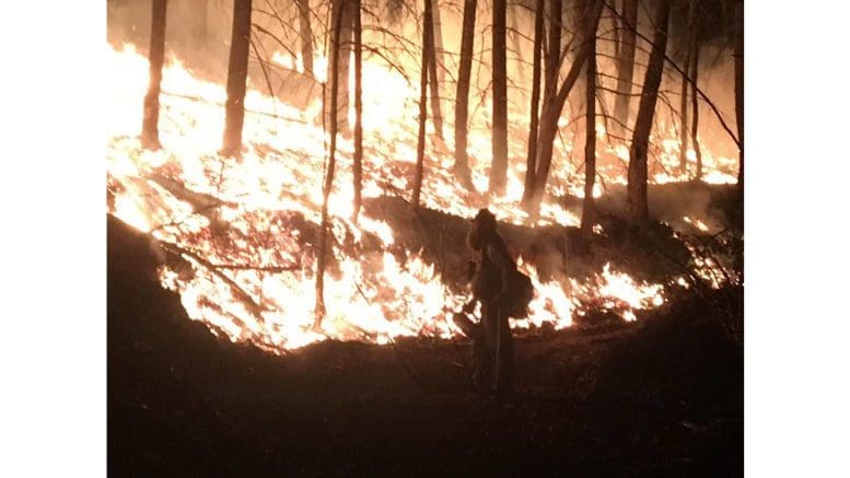
The National Weather Service issued a hazardous weather outlook that warns of high danger of fire in Cobb County and much of the rest of north Georgia on Friday October 14, followed by a cold front and the possibility of thunderstorms early next week.
What is in the statement?
The statement gives the following details:
“This Hazardous Weather Outlook is for portions of North and Central Georgia.
“.DAY ONE…Today and Tonight…
“High fire danger conditions are expected this afternoon through
this evening across north Georgia due to low relative humidities
and gusty winds. Relative humidities of 25 percent or less can be
expected for 4 or more hours this afternoon into this evening.
Winds will be west at 5 to 10 MPH with gusts up to 15 MPH.
“.DAYS TWO THROUGH SEVEN…Saturday through Thursday…
“A cold front will cross the area early next week with the
potential for rain showers and thunderstorms followed by cold
temperatures across north Georgia. Current forecast overnight lows
will bring the potential for frost and freeze to sensitive
vegetation starting Monday Night, so please continue to monitor
the forecast.
This Hazardous Weather Outlook is for portions of North and Central Georgia.
“.DAY ONE…Today and Tonight…
“High fire danger conditions are expected this afternoon through
this evening across north Georgia due to low relative humidities
and gusty winds. Relative humidities of 25 percent or less can be
expected for 4 or more hours this afternoon into this evening.
Winds will be west at 5 to 10 MPH with gusts up to 15 MPH.
“.DAYS TWO THROUGH SEVEN…Saturday through Thursday…
“A cold front will cross the area early next week with the
potential for rain showers and thunderstorms followed by cold
temperatures across north Georgia. Current forecast overnight lows
will bring the potential for frost and freeze to sensitive
vegetation starting Monday Night, so please continue to monitor
the forecast.”
Why does low relative humidity increase the danger of fire?
The National Park Service published the following explanation of why low relative humidity increases the danger of fires:
“Relative humidity is important because dead forest fuels and the air are always exchanging moisture. Low humidity takes moisture from the fuels, and fuels in turn, take moisture from the air when the humidity is high.
“Light fuels, such as grass and pine needles, gain and lose moisture quickly with changes in relative humidity. When the RH drops, fire behavior increases because these fine fuels become drier.
“Heavy fuels, on the other hand, respond to humidity changes more slowly. To see significant changes in heavy fuel moisture, there must be significant moisture, usually from more than a single storm.”
What counties are affected?
The following counties are included in the hazardous weather outlook:
Baldwin, Banks, Barrow, Bartow, Bibb, Bleckley, Butts, Carroll, Catoosa, Chattahoochee, Chattooga, Cherokee, Clarke, Clayton, Cobb, Coweta, Crawford, Crisp, Dade, Dawson, DeKalb, Dodge, Dooly, Douglas, Emanuel, Fannin, Fayette, Floyd, Forsyth, Gilmer, Glascock, Gordon, Greene, Gwinnett, Hall, Hancock, Haralson, Harris, Heard, Henry, Houston, Jackson, Jasper, Jefferson, Johnson, Jones, Lamar, Laurens, Lumpkin, Macon, Madison, Marion, Meriwether, Monroe, Montgomery, Morgan, Murray, Muscogee, Newton, North Fulton, Oconee, Oglethorpe, Paulding, Peach,
Pickens, Pike, Polk, Pulaski, Putnam, Rockdale, Schley, South Fulton, Spalding, Stewart, Sumter, Talbot, Taliaferro, Taylor, Telfair, Toombs, Towns, Treutlen, Troup, Twiggs, Union, Upson, Walker, Walton, Warren, Washington, Webster, Wheeler, White, Whitfield, Wilcox, Wilkes, Wilkinson
What precautions should be taken?
The National Weather Service recommends extreme caution if you do outdoor burning during high fire danger conditions, and that you check your local fire ordinances.
>> To read a summary of Cobb County’s fire ordinances follow this link
About the National Weather Service
The National Weather Service (NWS) is a part of the National Oceanic and Atmospheric Administration (NOAA).
The NWS describes its role as follows:
“The National Weather Service (NWS) provides weather, water, and climate forecasts and warnings for the United States, its territories, adjacent waters and ocean areas, for the protection of life and property and the enhancement of the national economy.
“These services include Forecasts and Observations, Warnings, Impact-based Decision Support Services, and Education in an effort to build a Weather-Ready Nation.
“The ultimate goal is to have a society that is prepared for and responds to weather, water and climate events.”
Read all the Cobb County Courier climate and weather coverage by following this link.