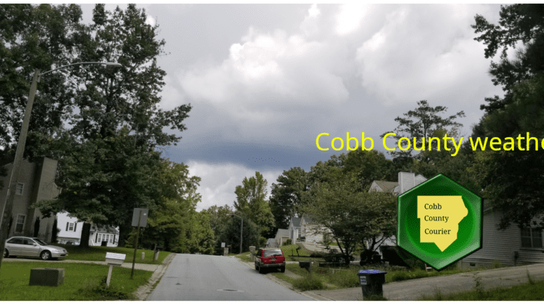
The National Weather Service forecasts increasing clouds here in Cobb County on Sunday, June 4, 2023, with a high near 83 degrees.
The National Weather Service has issued a hazardous weather outlook for Cobb County and other parts of the region due to scattered showers and thunderstorms that will develop by early this afternoon
What does the extended forecast have in store?
This forecast is centered on Dobbins Air Reserve Base in Marietta.
Today
Showers and thunderstorms likely, mainly after 5 p.m. Increasing clouds, with a high near 83. East wind around 10 mph, with gusts as high as 15 mph. Chance of precipitation is 60 percent.
Tonight
A 40 percent chance of showers and thunderstorms, mainly before 10 p.m. Partly cloudy, with a low around 63. East wind around 5 mph.
Monday
A 20 percent chance of showers and thunderstorms after 3 p.m. Mostly sunny, with a high near 85. Southeast wind around 5 mph becoming west in the afternoon.
Monday Night
A 10 percent chance of showers and thunderstorms before 8 p.m. Mostly clear, with a low around 66. West wind around 5 mph.
Tuesday
A 30 percent chance of showers and thunderstorms after 2 p.m. Mostly sunny, with a high near 89. West wind 5 to 10 mph, with gusts as high as 15 mph.
Tuesday Night
A 30 percent chance of showers and thunderstorms before 8 p.m. Mostly clear, with a low around 65.
Wednesday
A 20 percent chance of showers and thunderstorms after 2 p.m. Sunny, with a high near 88.
Wednesday Night
A 10 percent chance of showers and thunderstorms before 8 p.m. Partly cloudy, with a low around 64.
Thursday
A slight chance of showers, then a chance of showers and thunderstorms after 2 p.m. Mostly sunny, with a high near 86. Chance of precipitation is 30 percent.
Thursday Night
A 30 percent chance of showers and thunderstorms before 8 p.m. Partly cloudy, with a low around 61.
Friday
Sunny, with a high near 84.
Friday Night
Mostly clear, with a low around 62.
Saturday
A 20 percent chance of showers and thunderstorms. Sunny, with a high near 86.
What was the climate like in the latest reporting period?
The NWS climate summary for metro Atlanta has now been updated with November figures.
In an article entitled What is the Difference between Climate and Weather?, the National Ocean Service describes the difference as follows:
“Weather is what you see outside on any particular day. So, for example, it may be 75° degrees and sunny or it could be 20° degrees with heavy snow. That’s the weather.
“Climate is the average of that weather. For example, you can expect snow in the Northeast in January or for it to be hot and humid in the Southeast in July. This is climate. The climate record also includes extreme values such as record high temperatures or record amounts of rainfall. If you’ve ever heard your local weather person say “today we hit a record high for this day,” she is talking about climate records.
“So when we are talking about climate change, we are talking about changes in long-term averages of daily weather. In most places, weather can change from minute-to-minute, hour-to-hour, day-to-day, and season-to-season. Climate, however, is the average of weather over time and space.”
The climate report for the Atlanta area for the previous month shows how much departure from the average temperatures that month represents. The average temperature for a date is the average over a 30-year period.
| Date | Max temp | Min Temp | Average | Departure from norm | |
| 2023-05-01 | 68 | 50 | 59.0 | -8.3 | 0.00 |
| 2023-05-02 | 73 | 48 | 60.5 | -7.0 | 0.00 |
| 2023-05-03 | 72 | 48 | 60.0 | -7.8 | 0.00 |
| 2023-05-04 | 75 | 50 | 62.5 | -5.6 | 0.00 |
| 2023-05-05 | 64 | 58 | 61.0 | -7.3 | 0.01 |
| 2023-05-06 | 76 | 59 | 67.5 | -1.1 | 0.00 |
| 2023-05-07 | 83 | 61 | 72.0 | 3.1 | 0.00 |
| 2023-05-08 | 86 | 67 | 76.5 | 7.3 | T |
| 2023-05-09 | 85 | 68 | 76.5 | 7.1 | 0.00 |
| 2023-05-10 | 84 | 67 | 75.5 | 5.8 | 0.00 |
| 2023-05-11 | 81 | 67 | 74.0 | 4.0 | T |
| 2023-05-12 | 79 | 67 | 73.0 | 2.8 | 0.23 |
| 2023-05-13 | 86 | 65 | 75.5 | 5.0 | 0.00 |
| 2023-05-14 | 90 | 70 | 80.0 | 9.3 | 0.00 |
| 2023-05-15 | 85 | 70 | 77.5 | 6.5 | 0.06 |
| 2023-05-16 | 88 | 68 | 78.0 | 6.7 | 0.29 |
| 2023-05-17 | 81 | 66 | 73.5 | 2.0 | T |
| 2023-05-18 | 72 | 64 | 68.0 | -3.8 | T |
| 2023-05-19 | 73 | 61 | 67.0 | -5.0 | 0.00 |
| 2023-05-20 | 77 | 65 | 71.0 | -1.3 | 0.56 |
| 2023-05-21 | 80 | 65 | 72.5 | 0.0 | T |
| 2023-05-22 | 70 | 63 | 66.5 | -6.3 | 0.41 |
| 2023-05-23 | 72 | 64 | 68.0 | -5.0 | 0.01 |
| 2023-05-24 | 80 | 65 | 72.5 | -0.8 | 0.00 |
| 2023-05-25 | 81 | 62 | 71.5 | -2.0 | 0.00 |
| 2023-05-26 | 77 | 62 | 69.5 | -4.3 | 0.00 |
| 2023-05-27 | 77 | 60 | 68.5 | -5.5 | 0.00 |
| 2023-05-28 | 79 | 58 | 68.5 | -5.7 | 0.00 |
| 2023-05-29 | 75 | 62 | 68.5 | -6.0 | 0.00 |
| 2023-05-30 | 83 | 61 | 72.0 | -2.7 | 0.00 |
| 2023-05-31 | 79 | 67 | 73.0 | -1.9 | 0.00 |
| Sum | 2431 | 1928 | – | – | 1.57 |
| Average | 78.4 | 62.2 | 70.3 | -0.9 | – |
| Normal | 81.1 | 61.3 | 71.2 | – | 3.56 |
| Observations for each day cover the 24 hours endingat the time given below (Local Standard Time). |
| Max Temperature : midnight |
| Min Temperature : midnight |
| Precipitation : midnight |
| Snowfall : midnight |
| Snow Depth : 7am |
| Daily Data | Observed | Normal | Record Highest | Record Lowest | |
| Max Temperature | M | 85 | 98 in 1895 | 59 in 1967 | |
| Min Temperature | M | 66 | 75 in 1985 | 49 in 1972 | |
| Avg Temperature | M | 75.4 | 86.0 in 1985 | 55.0 in 1967 | |
| Precipitation | M | 0.13 | 1.55 in 1912 | 0.00 in 2022 | |
| Snowfall | M | 0.0 | 0.0 in 2022 | 0.0 in 2022 | |
| Snow Depth | M | – | 0 in 2022 | 0 in 2022 | |
| HDD (base 65) | M | 0 | 10 in 1967 | 0 in 2022 | |
| CDD (base 65) | M | 10 | 21 in 1985 | 0 in 1997 | |
| Month-to-Date Summary | Observed | Normal | Record Highest | Record Lowest | |
| Avg Max Temperature | 84.0 | 84.7 | 96.5 in 1895 | 62.5 in 1967 | |
| Avg Min Temperature | 64.0 | 65.8 | 73.5 in 2011 | 46.5 in 1889 | |
| Avg Temperature | 74.0 | 75.3 | 84.3 in 2011 | 57.5 in 1967 | |
| Total Precipitation | 0.00 | 0.26 | 2.86 in 2001 | 0.00 in 2023 | |
| Total Snowfall | 0.0 | 0.0 | 0.0 in 2023 | 0.0 in 2023 | |
| Max Snow Depth | M | – | 0 in 2022 | 0 in 2022 | |
| Total HDD (base 65) | 0 | 0 | 15 in 1967 | 0 in 2023 | |
| Total CDD (base 65) | 9 | 21 | 39 in 2011 | 0 in 1972 | |
| Year-to-Date Summary | Observed | Normal | Record Highest | Record Lowest | |
| Avg Max Temperature | 69.5 | 67.0 | 71.1 in 2017 | 59.8 in 1895 | |
| Avg Min Temperature | 51.0 | 47.1 | 51.6 in 1880 | 39.6 in 1940 | |
| Avg Temperature | 60.2 | 57.0 | 61.2 in 2017 | 50.0 in 1940 | |
| Total Precipitation | 20.93 | 21.45 | 39.15 in 1929 | 10.91 in 1986 | |
| Total Snowfall (since July 1) | 0.1 | 2.2 | 10.9 in 1936 | 0.0 in 2019 | |
| Max Snow Depth (since July 1) | 0 | – | 8 in 1940 | 0 in 2023 | |
| Total HDD (since July 1) | 1932 | 2529 | 3832 in 1977 | 1690 in 2017 | |
| Total CDD (since Jan 1) | 318 | 318 | 499 in 2019 | 111 in 1997 | |
| Period of Record:Max Temperature : 1878-10-04 to 2023-06-01Min Temperature : 1878-10-04 to 2023-06-01Precipitation : 1878-10-01 to 2023-06-01Snowfall : 1928-12-25 to 2023-06-01Snow Depth : 1928-12-25 to 2023-05-30 |
The climate summary for yesterday, Jun 2, 2023
CLIMATE REPORT
NATIONAL WEATHER SERVICE PEACHTREE CITY GA
418 AM EDT SUN JUN 04 2023
……………………………..
…THE ATLANTA CLIMATE SUMMARY FOR JUNE 3 2023…
CLIMATE NORMAL PERIOD: 1991 TO 2020
CLIMATE RECORD PERIOD: 1878 TO 2023
WEATHER ITEM OBSERVED TIME RECORD YEAR NORMAL DEPARTURE LAST
VALUE (LST) VALUE VALUE FROM YEAR
NORMAL
………………………………………………………….
TEMPERATURE (F)
YESTERDAY
MAXIMUM 89 3:45 PM 96 1936 85 4 86
MINIMUM 67 3:48 AM 46 1956 66 1 68
AVERAGE 78 76 2 77
PRECIPITATION (IN)
YESTERDAY 0.00 1.45 1892 0.14 -0.14 0.00
MONTH TO DATE 0.00 0.40 -0.40 0.00
SINCE JUN 1 0.00 0.40 -0.40 0.00
SINCE JAN 1 20.93 21.59 -0.66 21.52
DEGREE DAYS
HEATING
YESTERDAY 0 0 0 0
MONTH TO DATE 0 0 0 0
SINCE JUN 1 0 0 0 0
SINCE JUL 1 1932 2529 -597 2042
COOLING
YESTERDAY 13 11 2 12
MONTH TO DATE 35 31 4 46
SINCE JUN 1 35 31 4 46
SINCE JAN 1 344 329 15 416
………………………………………………………….
WIND (MPH)
RESULTANT WIND SPEED 8 RESULTANT WIND DIRECTION NE (60)
HIGHEST WIND SPEED 21 HIGHEST WIND DIRECTION E (80)
HIGHEST GUST SPEED 27 HIGHEST GUST DIRECTION NE (50)
AVERAGE WIND SPEED 8.4
SKY COVER
AVERAGE SKY COVER 0.4
WEATHER CONDITIONS
THE FOLLOWING WEATHER WAS RECORDED YESTERDAY.
NO SIGNIFICANT WEATHER WAS OBSERVED.
RELATIVE HUMIDITY (PERCENT)
HIGHEST 70 4:00 AM
LOWEST 31 1:00 PM
AVERAGE 51
………………………………………………….
THE ATLANTA CLIMATE NORMALS FOR TODAY
NORMAL RECORD YEAR
MAXIMUM TEMPERATURE (F) 85 98 1911
MINIMUM TEMPERATURE (F) 66 54 1879
1954
1969
SUNRISE AND SUNSET
JUNE 4 2023……….SUNRISE 6:28 AM EDT SUNSET 8:45 PM EDT
JUNE 5 2023……….SUNRISE 6:28 AM EDT SUNSET 8:45 PM EDT
– INDICATES NEGATIVE NUMBERS.
R INDICATES RECORD WAS SET OR TIED.
MM INDICATES DATA IS MISSING.
T INDICATES TRACE AMOUNT.
For much more information on the climate in our area, visit the NWS Climate FAQ for the Atlanta area.
What does the National Weather Service do?
The National Weather Service (NWS) is a part of the National Oceanic and Atmospheric Administration (NOAA).
The NWS describes its role as follows:
“The National Weather Service (NWS) provides weather, water, and climate forecasts and warnings for the United States, its territories, adjacent waters and ocean areas, for the protection of life and property and the enhancement of the national economy.
“These services include Forecasts and Observations, Warnings, Impact-based Decision Support Services, and Education in an effort to build a Weather-Ready Nation. The ultimate goal is to have a society that is prepared for and responds to weather, water and climate events.”