
photos by Gabriela Henriquez Stoikow
By Gabriela Henriquez Stoikow
The Mableton City Council unanimously approved the “Elevating Tomorrow Mableton 2045 – City of Mableton’s Inaugural Comprehensive Plan” which outlines how the city will become connected, inclusive, and resilient, with walkable mixed-use neighborhoods, small businesses and green corridors.
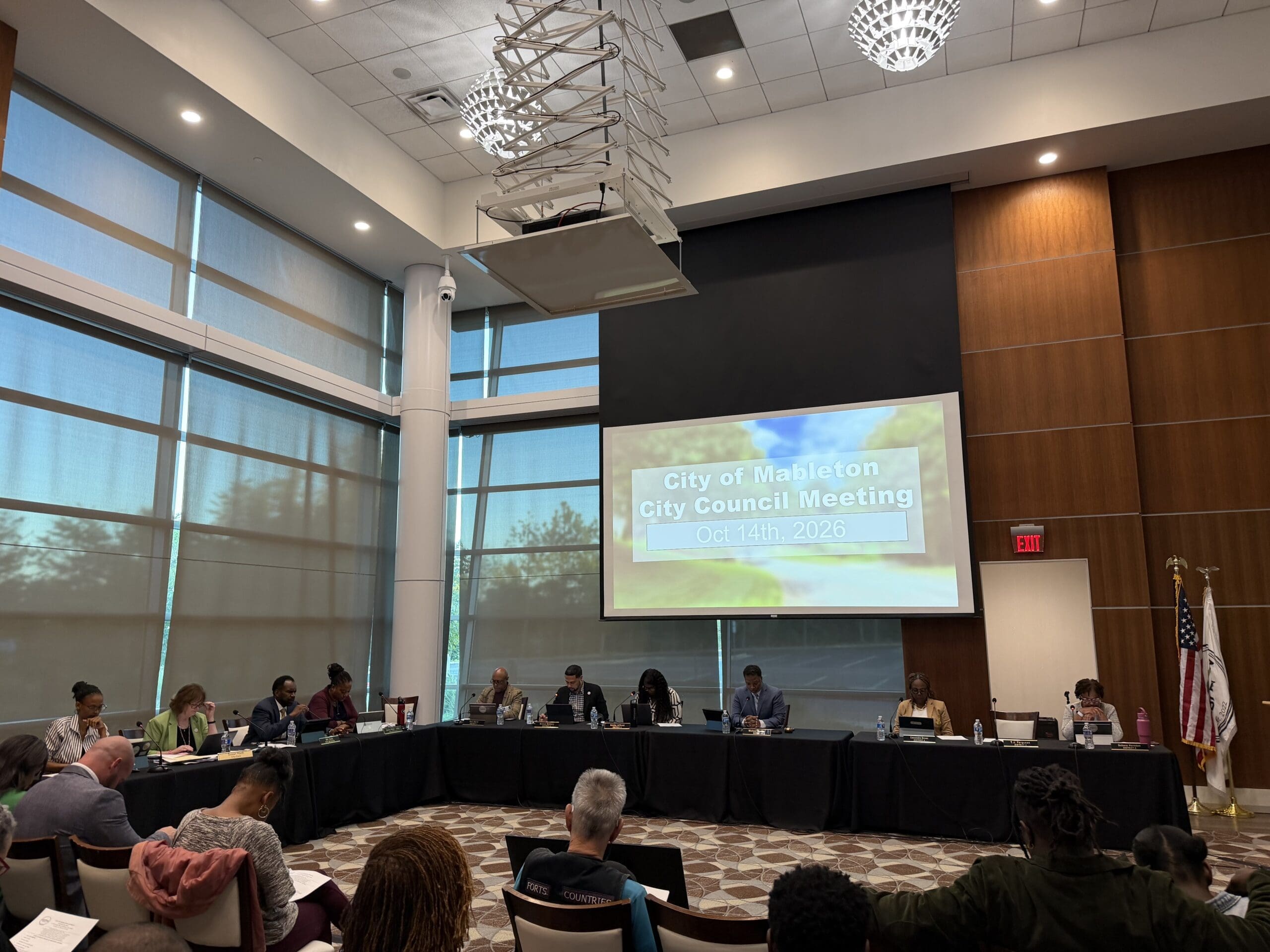
Mableton residents filled almost every seat at the city council meeting, held at the EpiCenter, eager to hear about the new plan, whose biggest proposal is creating a new city center near Veterans Memorial Highway, Floyd Road and Mableton Parkway, with walkability, mixed-use buildings, neighborhood commercial, and a “marquee public space.”
The Historic Downtown would be preserved, and current strip commercial at major intersections would be replaced with eight mixed-use villages with walkable clusters of local businesses, housing and public space. The plan proposes promoting the redevelopment around major city assets such as Six Flags, the Silver Comet Trail, Discovery Park, and the Chattahoochee River.
Corridors such as Veterans Memorial, Mableton Parkway and Floyd Road, will be converted gradually from auto-oriented commercial to housing or neighborhood retail, while Riverside Parkway’s garden apartments would be redeveloped into a mixed-use area that will prioritize affordability.
The I-20 area near Six Flags would become an entertainment district with hotels, dining and shops, and the plan floats a “downtown Six Flags” concept, similar to Universal’s City Walk in Florida. The aim is to encourage people to stay in Mableton while they visit the park. This is a request voiced by some Mableton residents who attended previous city council meetings.
Most of the city’s single-family areas, which stand at 55.1% of the city’s area, would stay as they are, and tree planting and walkability would be encouraged. Townhomes and duplexes will be allowed only inside master-planned developments. The city also aims to preserve at least 20% of its currently undeveloped land, prioritizing environmentally sensitive areas along rivers and streams.
To spur economic development, the plan proposes creating a downtown and smaller walkable cores that could attract small offices, restaurants and residents.
To address the narrowing housing market, the plan proposes some flexibility in zoning, by allowing duplexes and triplexes in single-family neighborhoods under certain conditions, reducing minimum home sizes, permitting zero-lot-line homes, and allowing accessory dwelling units in single-family zones. The plan also proposed to “pursue opportunities for senior-targeted housing on City property near the core of Mableton, including along Veterans Memorial Highway.”
Though the city has no transit city of its own and is reliant on the county, the Georgia Department of Transportation and the Atlanta Regional Commission, the plan puts together Complete Streets standards that accommodate pedestrians, cyclists, transit riders, and vehicles. It also proposes to “improve accessibility for persons with disabilities through ADA-compliant infrastructure and technology.” The plan has a Vision Zero policy to eliminate deaths and serious injuries, expand bus service and bus rapid transit, safe routes to school, and promote electric vehicle infrastructure.
The city also wants a plan to address the Concord Covered Bridge, which keeps being hit by trucks over its 7-foot clearance and it proposes corridor studies for Austell Road, East-West Connector, Floyd Road, Veterans Memorial and Mableton Parkway, and about a dozen intersection projects.
One recurring problem that residents raised when putting together the plan was litter and illegal dumping. To address this, the plan proposes “Clean Up Mableton!” which maps cleanup targets, more enforcement and volunteer partnerships, and points to exploring a facility like Atlanta’s CHaRM, which takes hard-to-recycle materials to divert them from local landfills and water systems, as an alternative to illicit dumping.
To preserve and increase the city’s tree canopy, which stands at about 45%, the plan proposes to plant trees along corridors with little canopy and to review the tree ordinance.
The plan proposes creating a local historic district for the Covered Bridge area, which is frequently damaged by trucks too tall. Also, to review design standards so they protect historic buildings, create a historic sites inventory, hire a public historian, collect oral histories, and build an online platform that includes stories of enslaved people, Native Americans, and other minorities.
Residents’ feedback also included interest in having more performances, public art, festivals, cultural programming for the youth and seniors, and youth programs. The plan also proposes providing universal broadband access of at least 1 Gbps upload and download, along with affordability programs for low-income and senior residents. The plan also proposed better connectivity for city buildings and public safety, and digital literacy training through schools and libraries.
You can find the full plan here.

Gabriela Henriquez Stoikow is a bilingual journalist based in Atlanta, Georgia, covering local news, immigration, and healthcare. She has previously worked at The Miami Herald, CNN, and Miami Today News, and her work has been featured in the Atlanta Business Chronicle, WABE, Rough Draft, and Documented NY. She won the Atlanta Press Club’s Rising Star Award in 2025 and was a finalist for the Reporting on Civil and Human Rights category of the Awards of Excellence in 2026.
Editor’s note: AI was used in the production of this article. In this case an AI tool was used to summarize the comprehensive plan and highlight key points, after which the reporter fact-checked the key points against the original document.
To read about how, when and why we make use of AI, read our article “How, When and Why the Cobb County Courier uses AI.”