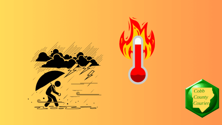
A Heat Advisory is in effect for parts of central and eastern Georgia today, with heat index values expected to reach up to 105 degrees. North and central Georgia will also see daily thunderstorm chances into early next week, with some storms capable of heavy rainfall, gusty winds and frequent lightning.
The National Weather Service issued a hazardous weather outlook for north and central Georgia for Saturday, June 13, 2026.
Bonus for the more weather-curious among you … To read an article about interpreting a weather news report with some of the typical terminology defined, follow this link.
What is in the Hazardous Weather Outlook?
The hazardous weather outlook states the following:
418 AM EDT Sat Jun 13 2026
This Hazardous Weather Outlook is for north and central Georgia.
.DAY ONE…Today and Tonight…
A Heat Advisory is in effect for portions of central and eastern
Georgia. Heat indices of up to 105 are expected. Please drink
plenty of fluids and take frequent breaks if outdoors..DAYS TWO THROUGH SEVEN…Sunday through Friday…
Daily thunderstorm chances will last through the weekend into
early next week. Some could become strong and bring the risk for
heavy rainfall, gusty winds, and frequent lightning.Heat index values over 100 degrees on Sunday could near Heat
Advisory criteria in some areas, especially in central Georgia.
Counties included in the alert
- Baldwin
- Banks
- Barrow
- Bartow
- Bibb
- Bleckley
- Butts
- Carroll
- Catoosa
- Chattahoochee
- Chattooga
- Cherokee
- Clarke
- Clayton
- Cobb
- Coweta
- Crawford
- Crisp
- Dade
- Dawson
- DeKalb
- Dodge
- Dooly
- Douglas
- Emanuel
- Fannin
- Fayette
- Floyd
- Forsyth
- Gilmer
- Glascock
- Gordon
- Greene
- Gwinnett
- Hall
- Hancock
- Haralson
- Harris
- Heard
- Henry
- Houston
- Jackson
- Jasper
- Jefferson
- Johnson
- Jones
- Lamar
- Laurens
- Lumpkin
- Macon
- Madison
- Marion
- Meriwether
- Monroe
- Montgomery
- Morgan
- Murray
- Muscogee
- Newton
- North Fulton
- Oconee
- Oglethorpe
- Paulding
- Peach
- Pickens
- Pike
- Polk
- Pulaski
- Putnam
- Rockdale
- Schley
- South Fulton
- Spalding
- Stewart
- Sumter
- Talbot
- Taliaferro
- Taylor
- Telfair
- Toombs
- Towns
- Treutlen
- Troup
- Twiggs
- Union
- Upson
- Walker
- Walton
- Warren
- Washington
- Webster
- Wheeler
- White
- Whitfield
- Wilcox
- Wilkes
- Wilkinson
What is meant by “isolated” and “scattered”?
The NWS defines “isolated” as follows:
A National Weather Service convective precipitation descriptor for a 10 percent chance of measurable precipitation (0.01 inch). Isolated is used interchangeably with few.
“Scattered” has the following definition:
When used to describe precipitation (for example: “scattered showers”) – Area coverage of convective weather affecting 30 percent to 50 percent of a forecast zone (s).
Isolated thunderstorms and scattered thunderstorms are two terms used to describe different distributions of thunderstorm activity within a particular area. The main difference lies in the extent of coverage and how the thunderstorms are spatially distributed:
- Isolated Thunderstorms:
· Isolated thunderstorms are relatively rare occurrences that happen sporadically and are generally confined to a limited area.
· These thunderstorms are often characterized by being few and far between, with significant gaps between individual storm cells.
· Typically, isolated thunderstorms cover less than 20% of the forecast area.
· Despite their isolated nature, these storms can still be intense and may produce heavy rain, lightning, gusty winds, and possibly hail.
- Scattered Thunderstorms:
· Scattered thunderstorms are more widespread than isolated thunderstorms and cover a larger portion of the forecast area.
· In a scattered thunderstorm scenario, numerous individual thunderstorms develop, but they are not continuous or widespread enough to be classified as a “line” or “cluster” of storms.
· Scattered thunderstorms generally cover between 30% to 50% of the forecast area.
· Although scattered thunderstorms are more widespread, they still leave considerable gaps between storm cells, and not everyone within the forecast area will necessarily experience a thunderstorm.
In summary, isolated thunderstorms are fewer in number and more localized, covering a smaller area with significant gaps between storms, while scattered thunderstorms are more widespread, covering a larger area with numerous individual storms occurring somewhat randomly across the forecast area.
About the National Weather Service
The National Weather Service (NWS) is a part of the National Oceanic and Atmospheric Administration (NOAA).
The NWS describes its role as follows:
The National Weather Service (NWS) provides weather, water, and climate forecasts and warnings for the United States, its territories, adjacent waters and ocean areas, for the protection of life and property and the enhancement of the national economy.
These services include Forecasts and Observations, Warnings, Impact-based Decision Support Services, and Education in an effort to build a Weather-Ready Nation.
Be the first to comment on "Heat advisory for central Georgia, thunderstorm risk across much of the state"