The hazardous weather outlook announced by the National Weather Service has now been escalated to a flood watch.
The NWS posted the following on its website:
…FLOOD WATCH IN EFFECT UNTIL 7 PM EST THIS EVENING…
* WHAT…Flooding caused by excessive rainfall is possible.
* WHERE…Portions of central Georgia, east central Georgia, north central Georgia, northeast Georgia, northwest Georgia and west central Georgia, including the following areas, in central Georgia, Butts, Jasper and Putnam. In east central Georgia, Greene, Taliaferro and Wilkes. In north central Georgia, Barrow, Cherokee, Clayton, Cobb, DeKalb, Douglas, Fayette, Forsyth, Gwinnett, Hall, Henry, Morgan, Newton, North Fulton, Rockdale, South Fulton and Walton. In northeast Georgia, Banks, Clarke, Jackson, Madison, Oconee and Oglethorpe. In northwest Georgia, Bartow, Carroll, Floyd, Haralson, Paulding and Polk. In west central Georgia, Coweta, Heard, Meriwether, Pike, Spalding and Troup.
* WHEN…Until 7 PM EST this evening.
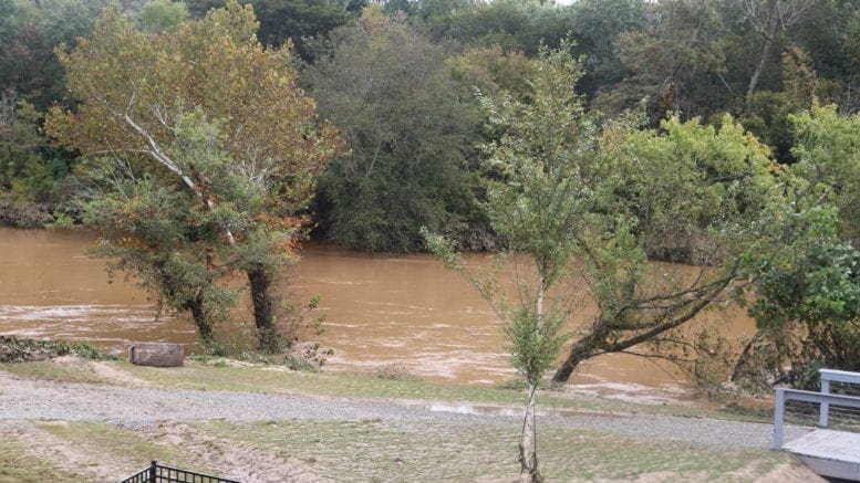
* IMPACTS…Excessive runoff may result in flooding of rivers, creeks, streams, and other low-lying and flood-prone locations. Creeks and streams may rise out of their banks. Flooding may occur in poor drainage and urban areas.
* ADDITIONAL DETAILS… – Areas of heavy rainfall will continue to slowly move across portions of the area through this afternoon. Additional rainfall totals of one to two inches with locally higher amounts are expected on top of already saturated grounds. Localized flash flooding and quick rises on creeks and streams is possible through this evening. – http://www.weather.gov/safety/flood PRECAUTIONARY/PREPAREDNESS ACTIONS… You should monitor later forecasts and be alert for possible Flood Warnings. Those living in areas prone to flooding should be prepared to take action should flooding develop.