
The U.S. Census Bureau has released a set of data visualization tools for the 2020 census to examine the population traits of areas down to the census tract level.
Census tracts are in many ways the ideal unit when looking at the characteristics of a region within a county. Zipcodes are too large to make meaningful observations about an area, and often overlap county boundaries. Census blocks are the smallest census unit, but not all data is collected for the census block level.
So we’re going to identify the densest community in Cobb County by its census tract.
The tool used to put this together was the 2020 Census Demographic Data Map Viewer.
The map below is a screenshot of the tool’s output, zoomed into Cobb County. The darker the area, the higher the population density.

Three things are worth pointing out.
The first is that Cobb’s overall population density is in second place of the five largest metro counties, exceeded only by Dekalb.
Here are the figures for persons per square mile:
| Dekalb | 2,854.9 |
| Cobb | 2,254.8 |
| Gwinnett | 2,221.8 |
| Clayton | 2,100.9 |
| Fulton | 2,025.3 |
(Fulton’s low overall density is primarily because the high-density areas in the City of Atlanta are offset by extremely low-density areas over a large portion of South Fulton).
The second is that despite East Cobb’s general reputation of detached houses on large lots, the largest swaths of low population density are in West Cobb and the areas near Mableton. and south of Smyrna.
The third is that the five patches of very low density (areas below 1,000 persons per square mile) are associated with large parks (Allatoona, Lost Mountain, Kennesaw Mountain), a military base with an adjacent aircraft manufacturer (Dobbins ARB and the Lockheed Martin facility), and an industrial area (South Cobb south of I-20).
The densest census tract in Cobb County
There is only one census tract in Cobb County that exceeds a population density of 10,000 persons per square mile, and that is tract 304.14.
This tract is bounded by I-75 to the west, Powers Ferry Road to the east, Delk Road to the north, and Terrell Mill Road on the south, and has a population density of 10,902 persons per square mile. To put that in perspective though, it’s nowhere approaching New York City levels of density, where many census tracts exceed 100,000 persons per square mile.
Here is a screenshot of 304.14.
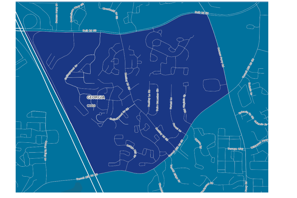
While there are a number of census tracts in the county in the range of 5,000-10,000 persons per square mile, the only tract in that range approaching 10,000 is a census tract in Vinings, 312.19, with 9,167.9 persons per square mile.
To make use of this tool yourself …
The tool is pretty easy to use, and I’ve included a link in the button below. To use it just drag Georgia to the middle of the map and zoom in, either with the plus key or your mouse wheel, then center the map on Cobb County and keep zooming in until you recognize highway and street names. Then you can find your own census tract or any track you’re interested in, and clicking on it will give the population density.