The National Weather Service, has issued a dual hazardous weather outlook for Cobb County and much of the rest of north Georgia warning of high fire danger in the afternoon and evening followed by a second outlook of isolated to scattered thunderstorms overnight Friday through Saturday.
The NWS defines “isolated” as follows:
A National Weather Service convective precipitation descriptor for a 10 percent chance of measurable precipitation (0.01 inch). Isolated is used interchangeably with few.
The NWS describes “scattered” as follows:
When used to describe precipitation (for example: “scattered showers”) – Area coverage of convective weather affecting 30 percent to 50 percent of a forecast zone (s).
What is in the hazardous weather outlook?
Here is the first message from the NWS:
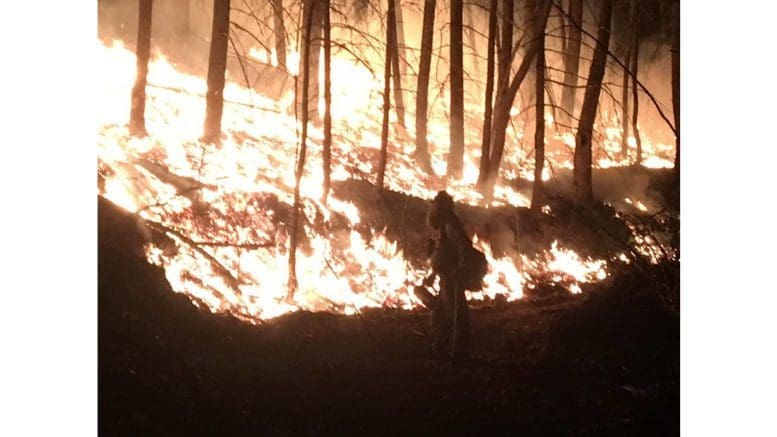
…HIGH FIRE DANGER CONDITIONS THIS AFTERNOON INTO THE EVENING
FOR PARTS OF NORTH AND CENTRAL GEORGIA DUE TO LOW RELATIVE
HUMIDITIES…
Relative Humidities of 25 percent or less can be expected for 4
or more hours this afternoon into the evening. Winds will be east
around 10 MPH.
With dry fuels, high fire danger conditions can be expected.
Please refer to your local burn permitting authorities
whether you may burn outdoors. If you do burn outside,
use extreme caution.
This outlook lasts during the afternoon Friday and into the evening.
The following counties are listed in the outlook:
Fannin-Gilmer-Union-Towns-Pickens-Dawson-Lumpkin-White-Bartow-
Cherokee-Forsyth-Hall-Banks-Jackson-Madison-Polk-Paulding-Cobb-
North Fulton-Gwinnett-Barrow-Clarke-Oconee-Oglethorpe-Haralson-
Carroll-Douglas-South Fulton-DeKalb-Rockdale-Walton-Newton-Morgan-
Heard-Coweta-Fayette-Clayton-Spalding-Henry-Butts-Jasper-Troup-
Meriwether-Pike-Lamar-
The second outlook concerning the possibility of isolated to scattered thunderstorms contains the following information:
This Hazardous Weather Outlook is for portions of North and Central Georgia.
.DAY ONE…Today and Tonight…
Isolated to scattered thunderstorms are possible overnight as a
cold front moves southward across the forecast area.
.DAYS TWO THROUGH SEVEN…Saturday through Thursday…
Isolated to scattered thunderstorms are possible Saturday through
Monday.
This message covers a wider region, and includes the following counties:
Baldwin-Banks-Barrow-Bartow-Bibb-Bleckley-Butts-Carroll-Catoosa-
Chattahoochee-Chattooga-Cherokee-Clarke-Clayton-Cobb-Coweta-
Crawford-Crisp-Dade-Dawson-DeKalb-Dodge-Dooly-Douglas-Emanuel-
Fannin-Fayette-Floyd-Forsyth-Gilmer-Glascock-Gordon-Greene-
Gwinnett-Hall-Hancock-Haralson-Harris-Heard-Henry-Houston-Jackson-
Jasper-Jefferson-Johnson-Jones-Lamar-Laurens-Lumpkin-Macon-
Madison-Marion-Meriwether-Monroe-Montgomery-Morgan-Murray-
Muscogee-Newton-North Fulton-Oconee-Oglethorpe-Paulding-Peach-
Pickens-Pike-Polk-Pulaski-Putnam-Rockdale-Schley-South Fulton-
Spalding-Stewart-Sumter-Talbot-Taliaferro-Taylor-Telfair-Toombs-
Towns-Treutlen-Troup-Twiggs-Union-Upson-Walker-Walton-Warren-
Washington-Webster-Wheeler-White-Whitfield-Wilcox-Wilkes-
Wilkinson-
About the National Weather Service
The National Weather Service (NWS) is a part of the National Oceanic and Atmospheric Administration (NOAA).
The NWS describes its role as follows:
The National Weather Service (NWS) provides weather, water, and climate forecasts and warnings for the United States, its territories, adjacent waters and ocean areas, for the protection of life and property and the enhancement of the national economy. These services include Forecasts and Observations, Warnings, Impact-based Decision Support Services, and Education in an effort to build a Weather-Ready Nation. The ultimate goal is to have a society that is prepared for and responds to weather, water and climate events.
Read all the Cobb County Courier climate and weather coverage by following this link.