According to a bulletin from the National Weather Service issued at 2 a.m. on Friday September 30, Hurricane Ian gathered strength and is expected to make landfall in South Carolina later today. The main danger to Cobb County and the north Georgia area are high winds, and the National Weather Service has issued a wind advisory in effect until 8 p.m. Friday for counties in north and central Georgia.
The storm is now located about 175 miles SSE of Charleston, South Carolina, and about 260 miles SSW of Cape Fear, North Carolina, with winds of around 85 mph.
The update states the following:
At 200 AM EDT (0600 UTC), the center of Hurricane Ian was located near latitude 30.3 North, longitude 79.2 West. Ian is moving toward the north-northeast near 10 mph (17 km/h). A turn toward the north is expected later today, followed by a turn toward the north-northwest with an increase in forward speed tonight.
On the forecast track, Ian will approach and reach the coast of South Carolina today. The center will move farther inland across the Carolinas tonight and Saturday. Maximum sustained winds are near 85 mph (140 km/h) with higher gusts. Little change in strength is expected before Ian makes landfall later today, and rapid weakening is forecast over the southeastern United States late today into Saturday. Hurricane-force winds extend outward up to 45 miles (75 km) from the center and tropical-storm-force winds extend outward up to 415 miles (665 km). The minimum central pressure reported by an Air Force Hurricane Hunter aircraft is 984 mb (29.06 inches).
HAZARDS AFFECTING LAND ———————- Key messages for Ian can be found in the Tropical Cyclone Discussion under AWIPS header MIATCDAT4 and WMO header WTNT44 KNHC and on the web at hurricanes.gov/text/MIATCDAT4.shtml.
STORM SURGE: The combination of storm surge and the tide will cause normally dry areas near the coast to be flooded by rising waters moving inland from the shoreline.
The water could reach the following heights above ground somewhere in the indicated areas if the peak surge occurs at the time of high tide…
* Edisto Beach to Little River Inlet…4-7 ft
* Flagler/Volusia County Line to Edisto Beach…3-5 ft
* Litter River Inlet to Cape Fear…3-5 ft * Cape Fear River…2-4 ft * St. Johns River…2-4 ft
* East of Cape Fear to Duck, including Pamlico and Neuse Rivers…2-4 ft
* Patrick Air Force Base to Flagler/Volusia County Line… 1-3 ft
* Albemarle Sound…1-2 ft The deepest water will occur along the immediate coast near and to the right of the center, where the surge will be accompanied by large waves.
Surge-related flooding depends on the relative timing of the surge and the tidal cycle, and can vary greatly over short distances. For information specific to your area, please see products issued by your local National Weather Service forecast office.
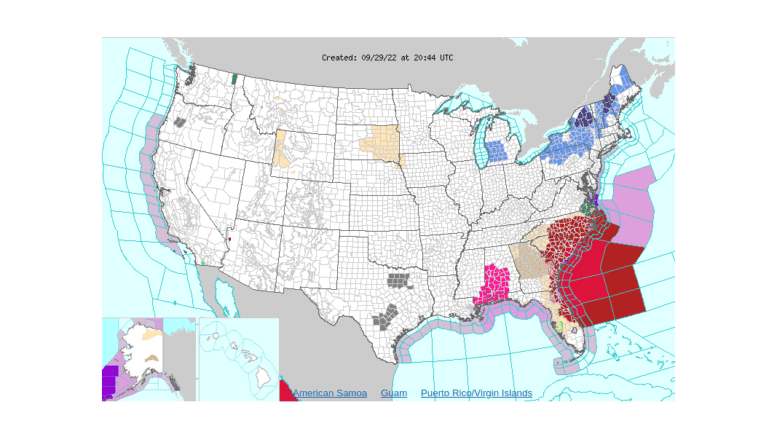
WIND: Tropical storm conditions are occurring in parts of the warning areas on the northeast coast of Florida, Georgia, and the Carolinas, and hurricane conditions are expected to begin in the Hurricane Warning area later today. Hurricane conditions are possible within the Hurricane Watch area in North Carolina later today.
RAINFALL: Ian is expected to produce the following storm total rainfall amounts:
* Coastal Georgia: 1 to 2 inches. * Northeast South Carolina: 4 to 8 inches, with local maxima of 12 inches.
* Central South Carolina, North Carolina, and southern Virginia: 3 to 6 inches with local maxima of 8 inches across northwest North Carolina and southwest Virginia. Major to record river flooding will continue across central Florida through next week.
Considerable flash and urban flooding, and minor river flooding is possible across coastal and northeast South Carolina today. Locally considerable flash, urban, and small stream flooding is possible today into Saturday across portions of northwest North Carolina and southwest Virginia.
Limited flooding is possible across portions of the southern Mid-Atlantic this weekend.
TORNADOES: The potential for a few tornadoes will begin later this morning along a portion of the coastal Carolinas, spread inland across eastern North Carolina during the afternoon and evening, and shift into southeast Virginia overnight through early Saturday morning.
SURF: Swells generated by Ian and a nearby frontal system are affecting the east coast of Florida, Georgia, the Carolinas, and the northwestern Bahamas. These swells are likely to cause life-threatening surf and rip current conditions. Please consult products from your local weather office. Swells will subside along the northern coast of Cuba and the northeastern coast of the Yucatan peninsula today.