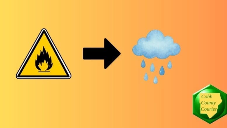
Dry conditions and low humidity could pose a fire weather risk in northeast Georgia today, while a round of rain and isolated thunderstorms is expected Thursday into Friday morning, with no severe weather anticipated.
The National Weather Service issued a hazardous weather outlook for north and central Georgia for Tuesday, December 17.
Bonus for the more weather-curious among you … To read an article about interpreting a weather news report with some of the typical terminology defined, follow this link.
What is in the statement?
The statement gives the following details:
This Hazardous Weather Outlook is for north and central Georgia.
.DAY ONE…Today and Tonight…
Low relative humidity values and dry fuels could make for pockets of hazardous fire weather conditions along the peaks and ridges of northeast Georgia this afternoon.
.DAYS TWO THROUGH SEVEN…Thursday through Tuesday…
Showers are expected Thursday afternoon into Friday morning, with rumbles of thunder possible. Widespread severe weather is not anticipated.
The following counties are included in the hazardous weather outlook:
Baldwin, Banks, Barrow, Bartow, Bibb, Bleckley, Butts, Carroll, Catoosa, Chattahoochee, Chattooga, Cherokee, Clarke, Clayton, Cobb, Coweta, Crawford, Crisp, Dade, Dawson, DeKalb, Dodge, Dooly, Douglas, Emanuel, Fannin, Fayette, Floyd, Forsyth, Gilmer, Glascock, Gordon, Greene, Gwinnett, Hall, Hancock, Haralson, Harris, Heard, Henry, Houston, Jackson, Jasper, Jefferson, Johnson, Jones, Lamar, Laurens, Lumpkin, Macon, Madison, Marion, Meriwether, Monroe, Montgomery, Morgan, Murray, Muscogee, Newton, North Fulton, Oconee, Oglethorpe, Paulding, Peach, Pickens, Pike, Polk, Pulaski, Putnam, Rockdale, Schley, South Fulton, Spalding, Stewart, Sumter, Talbot, Taliaferro, Taylor, Telfair, Toombs, Towns, Treutlen, Troup, Twiggs, Union, Upson, Walker, Walton, Warren, Washington, Webster, Wheeler, White, Whitfield, Wilcox, Wilkes, Wilkinson
What is meant by “isolated” and “scattered”?
The NWS defines “isolated” as follows:
A National Weather Service convective precipitation descriptor for a 10 percent chance of measurable precipitation (0.01 inch). Isolated is used interchangeably with few.
“Scattered” has the following definition:
When used to describe precipitation (for example: “scattered showers”) – Area coverage of convective weather affecting 30 percent to 50 percent of a forecast zone(s).
Isolated thunderstorms and scattered thunderstorms are two terms used to describe different distributions of thunderstorm activity within a particular area. The main difference lies in the extent of coverage and how the thunderstorms are spatially distributed:
Isolated Thunderstorms:
- Relatively rare occurrences that happen sporadically and are generally confined to a limited area.
- Few and far between, with significant gaps between individual storm cells.
- Typically cover less than 20% of the forecast area.
- Can still be intense, with heavy rain, lightning, gusty winds, and possibly hail.
Scattered Thunderstorms:
- More widespread and cover a larger portion of the forecast area.
- Numerous individual thunderstorms that are not continuous or widespread enough to form a line or cluster.
- Generally cover 30% to 50% of the area.
- Still leave considerable gaps, and not everyone in the area will experience a storm.
In summary, isolated thunderstorms are fewer in number and more localized, while scattered thunderstorms are more widespread with randomly occurring individual storms.
About the National Weather Service
The National Weather Service (NWS) is a part of the National Oceanic and Atmospheric Administration (NOAA).
The National Weather Service (NWS) provides weather, water, and climate forecasts and warnings for the United States, its territories, adjacent waters and ocean areas, for the protection of life and property and the enhancement of the national economy.
These services include Forecasts and Observations, Warnings, Impact-based Decision Support Services, and Education in an effort to build a Weather-Ready Nation. The ultimate goal is to have a society that is prepared for and responds to weather, water and climate events.