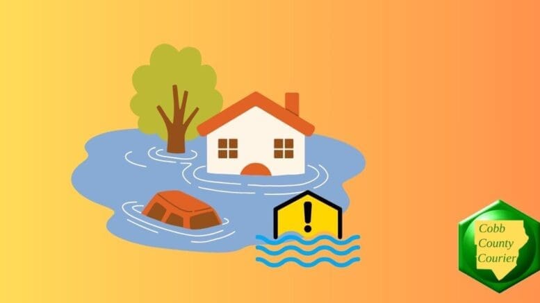
A Flood Watch remains in effect for portions of north Georgia through Saturday evening, with the potential for flash flooding due to excessive rainfall.
The National Weather Service issued a hazardous weather outlook for north and central Georgia for Saturday, January 10.
Bonus for the more weather-curious among you … To read an article about interpreting a weather news report with some of the typical terminology defined, follow this link.
What is in the statement?
The statement gives the following details:
…FLOOD WATCH REMAINS IN EFFECT THROUGH THIS EVENING…
* WHAT…Flash flooding caused by excessive rainfall continues to be possible.
* WHERE…Portions of north Georgia, including the following counties, Bartow, Catoosa, Chattooga, Cherokee, Cobb, Dade, Dawson, Fannin, Floyd, Gilmer, Gordon, Haralson, Lumpkin, Murray, Paulding, Pickens, Polk, Towns, Union, Walker, Whitfield, and White.
* WHEN…Through Saturday evening.
* IMPACTS…Excessive runoff may result in flooding of rivers, creeks, streams, and other low-lying and flood-prone locations. Flooding may occur in poor drainage and urban areas.
* ADDITIONAL DETAILS…
– Multiple rounds of rainfall are expected to impact portions of north Georgia overnight into Saturday afternoon, when a front will move through and end the threat. Widespread rainfall totals of 2-4″ with locally higher amounts up to 6″ possible. Convective rainfall (thunderstorms) will also be possible during this time, which may have locally high enough rainfall rates to induce flash flooding in poor drainage areas, as well as creeks and streams prone to flash flooding given the antecedent rainfall. Larger stem riverine flooding is not anticipated given the ongoing drought and low base state that these rivers are starting from.
– http://www.weather.gov/safety/flood
PRECAUTIONARY/PREPAREDNESS ACTIONS…
You should monitor forecasts and be prepared to take action should Flash Flood Warnings be issued.
Here is the text of the Hazardous Weather Outlook:
This Hazardous Weather Outlook is for north and central Georgia.

.DAY ONE...Today and Tonight...

Continued periods of moderate to heavy rainfall are expected
across portions of north Georgia as far south as Interstate 20
through mid morning. Instances of flash flooding and flooding of
smaller creeks and streams will remain a concern through the
afternoon. A Flood Watch remains in effect through 8 PM this
evening.

A few storms this morning and early afternoon could become severe,
capable of producing damaging wind gusts. A brief, isolated
tornado also cannot be ruled out. A Tornado Watch is in effect
through 11 AM this morning in portions of northwest and west-
central Georgia.

.DAYS TWO THROUGH SEVEN...Sunday through Friday...

The threat for hazardous weather remains low.
What counties are affected?
The following counties are included in the hazardous weather outlook: Dade, Walker, Catoosa, Whitfield, Murray, Fannin, Gilmer, Union, Towns, Chattooga, Gordon, Pickens, Dawson, Lumpkin, White, Floyd, Bartow, Cherokee, Polk, Paulding, Cobb, Haralson
What is meant by “isolated” and “scattered”?
The NWS defines “isolated” as follows:
A National Weather Service convective precipitation descriptor for a 10 percent chance of measurable precipitation (0.01 inch). Isolated is used interchangeably with few.
“Scattered” has the following definition:
When used to describe precipitation (for example: “scattered showers”) – Area coverage of convective weather affecting 30 percent to 50 percent of a forecast zone(s).
Isolated thunderstorms and scattered thunderstorms are two terms used to describe different distributions of thunderstorm activity within a particular area. The main difference lies in the extent of coverage and how the thunderstorms are spatially distributed:
Isolated Thunderstorms:
- Isolated thunderstorms are relatively rare occurrences that happen sporadically and are generally confined to a limited area.
- These thunderstorms are often characterized by being few and far between, with significant gaps between individual storm cells.
- Typically, isolated thunderstorms cover less than 20% of the forecast area.
- Despite their isolated nature, these storms can still be intense and may produce heavy rain, lightning, gusty winds, and possibly hail.
Scattered Thunderstorms:
- Scattered thunderstorms are more widespread than isolated thunderstorms and cover a larger portion of the forecast area.
- In a scattered thunderstorm scenario, numerous individual thunderstorms develop, but they are not continuous or widespread enough to be classified as a “line” or “cluster” of storms.
- Scattered thunderstorms generally cover between 30% to 50% of the forecast area.
- Although scattered thunderstorms are more widespread, they still leave considerable gaps between storm cells, and not everyone within the forecast area will necessarily experience a thunderstorm.
In summary, isolated thunderstorms are fewer in number and more localized, covering a smaller area with significant gaps between storms, while scattered thunderstorms are more widespread, covering a larger area with numerous individual storms occurring somewhat randomly across the forecast area.
About the National Weather Service
The National Weather Service (NWS) is a part of the National Oceanic and Atmospheric Administration (NOAA).
The NWS describes its role as follows:
The National Weather Service (NWS) provides weather, water, and climate forecasts and warnings for the United States, its territories, adjacent waters and ocean areas, for the protection of life and property and the enhancement of the national economy.
These services include Forecasts and Observations, Warnings, Impact-based Decision Support Services, and Education in an effort to build a Weather-Ready Nation. The ultimate goal is to have a society that is prepared for and responds to weather, water and climate events.