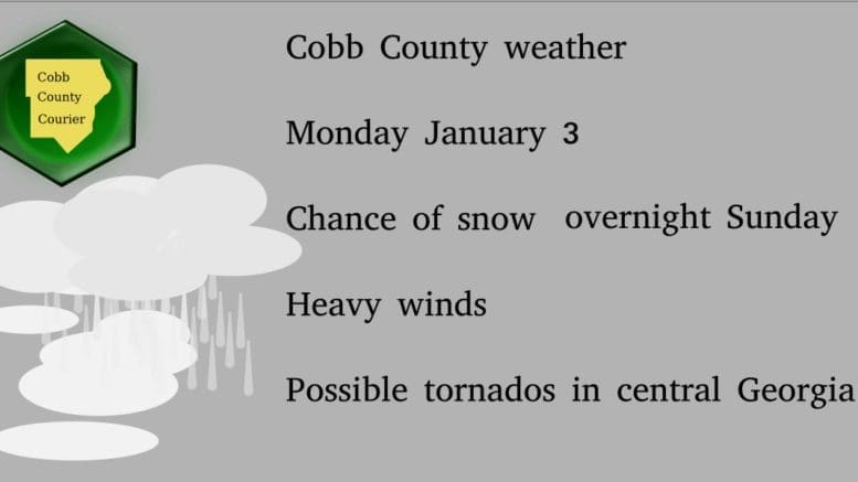
The National Weather Service has posted three new hazardous weather outlooks for Cobb County and other parts of North Georgia. The forecast is for a chance of an up to one-inch dusting of snow, with wind gusts of up to 35 mph.
Here are the advisories posted on the NWS website.
…WINTER WEATHER ADVISORY IN EFFECT FROM MIDNIGHT TONIGHT TO 9 AM EST MONDAY
… * WHAT…Wet snow expected with light snow accumulations from a dusting up to one inch. Winds gusting as high as 35 mph.
* WHERE…Cobb, Carroll and Douglas Counties.
* WHEN…From midnight tonight to 9 AM EST Monday. * IMPACTS…Plan on slippery road conditions. The hazardous conditions could impact the morning commute. PRECAUTIONARY/PREPAREDNESS ACTIONS… Slow down and use caution while traveling.
.DAY ONE…This Afternoon through Monday Morning…
A Tornado Watch has been issued for portions of central Georgia until 9 PM EST where a broken line of showers and thunderstorms will be capable of producing scattered damaging wind gusts and a tornado or two. Tonight, a wintry mix of rain and snow is expected to begin after midnight for portions of northern Georgia through 9 AM EST. A Winter Weather Advisory has been issued for portions of north and northwest Georgia, mostly along and north of I-85 where snow accumulations could range from a dusting to 2 inches. In the higher elevations, mostly above 1500ft in far north Georgia, a Winter Storm Warning has been issued with snow accumulations between 1-4 inches possible. In addition, strong sustained winds from the northwest behind the cold front tonight into tomorrow morning has prompted a Wind Advisory with sustained winds from 15 to 25 mph with occasional gusts up to 40 mph expected. .DAYS TWO THROUGH SEVEN…Monday through Saturday… Snow showers will be exiting the region Monday morning with strong winds expected through noon, especially in areas of high terrain in the north Georgia mountains. Please use caution when driving as roads Monday morning as they may become slick
. .SPOTTER INFORMATION STATEMENT… Spotter activation is requested for today across portions of north and central Georgia
. …WIND ADVISORY IN EFFECT FROM MIDNIGHT TONIGHT TO NOON EST MONDAY…
* WHAT…Northwest winds 15 to 25 mph with gusts up to 40 mph expected.
* WHERE…Portions of central, east central, north central, northeast, northwest, southeast and west central Georgia.
* WHEN…From midnight tonight to noon EST Monday.
* IMPACTS…Gusty winds could blow around unsecured objects. Tree limbs could be blown down and a few power outages may result.
7-day forecast
The following is the NWS 7-day weather forecast, centered on Dobbins ARB in Marietta:
Overnight Sunday Windy. Chance of rain late, then rain in the late evening and early morning. Chance of rain and snow late. Snow accumulation up to 1 inch. Lows in the lower 30s. North winds 5 to 10 mph increasing to northwest 15 to 25 mph. Chance of precipitation 90 percent.
Monday Windy, sunny. Highs in the lower 40s. Northwest winds 10 to 20 mph.
Monday Night Clear. Lows in the upper 20s. Northwest winds up to 10 mph shifting to the northeast after midnight.
Tuesday Sunny. Highs in the upper 40s. Southeast winds 10 to 15 mph.
Tuesday Night Increasing clouds. Lows in the mid 30s. Southeast winds up to 10 mph.
Wednesday Mostly cloudy. Highs in the mid 50s.
Wednesday Night Mostly cloudy with a slight chance of showers. Lows in the mid 30s. Chance of rain 20 percent.
Thursday Showers likely. Highs in the lower 50s. Chance of rain 60 percent.
Thursday Night Partly cloudy with a chance of showers in the evening. Lows in the mid 20s. Chance of rain 30 percent.
Friday Sunny. Highs in the lower 40s.
Friday Night Clear. Lows in the upper 20s.SaturdaySunny. Highs in the upper 40s.
Saturday Night Mostly cloudy with a chance of showers. Lows in the upper 30s. Chance of rain 30 percent.
Sunday Mostly cloudy with a chance of showers. Highs in the mid 50s. Chance of rain 50 percent.
About the National Weather Service
The National Weather Service (NWS) is a part of the National Oceanic and Atmospheric Administration (NOAA).
The NWS describes its role as follows:
The National Weather Service (NWS) provides weather, water, and climate forecasts and warnings for the United States, its territories, adjacent waters and ocean areas, for the protection of life and property and the enhancement of the national economy. These services include Forecasts and Observations, Warnings, Impact-based Decision Support Services, and Education in an effort to build a Weather-Ready Nation. The ultimate goal is to have a society that is prepared for and responds to weather, water and climate events.
Read all the Cobb County Courier climate and weather coverage by following this link.