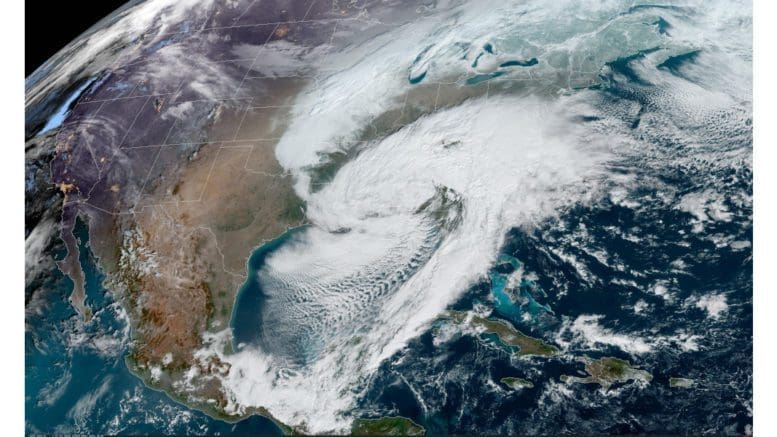
We generally focus on the weather in our Cobb County area, but the wintry weather and high winds are part of a much larger storm that’s moving across the eastern United States and heading northwestward toward Canada.
The National Weather Service posted the following Short Range Forecast Discussion that gives an overview of what’s happening nationally between now and next Tuesday, January 18:
Short Range Forecast Discussion
..Heavy Snow for parts of the Central/Southern Appalachians, Lower Great
Lakes/Ohio Valley, Mid-Atlantic, and the Northeast on Sunday...

...Significant rain/freezing rain for parts of the Mid-Atlantic and the
Central/Southern Appalachians; Light rain/freezing rain for parts
Northeast on Sunday...

...Some heavy rain, strong thunderstorms, and high winds can be expected
to impact the coastal sections of the southern Mid-Atlantic and Southeast
Coast Sunday into Monday...

A strong storm over the Southeast/Southern Appalachians will move
northeastward inland from the coast to Southeastern Canada by Tuesday. The
system will produce rain, thunderstorms, snow, and rain/freezing rain from
the Lower Mississippi Valley to the Southeast/southern Mid-Atlantic,
Sunday.

Heavy snow will extend from the Tennessee Valley, Central/Southern
Appalachians, and parts of the Mid-Atlantic, with significant
rain/freezing rain over parts of the Southeast, Central/Southern
Appalachians, Mid-Atlantic from Sunday morning to Sunday evening. From
Sunday evening into Monday morning, heavy snow will extend into parts of
the Ohio Valley, Lower Great Lakes, and Northeast. Also, rain/freezing
rain will move into parts of the northern Mid-Atlantic and Northeast.
Furthermore, the rain will move into parts of the northern Mid-Atlantic
and Southern New England overnight Sunday. On Monday, as the storm moves
across the Northeast, the rain will develop over the coastal regions of
Maine with heavy snow inland. Light snow will linger over parts of the
Central/Southern Appalachians into the Northeast by Monday evening into
Tuesday. The heavy snow will end overnight Monday over Maine. The
combination of snow and ice may cause hazardous road conditions during and
after the storm.

Meanwhile, a boundary over Central Canada will move into the Upper Midwest
by Sunday evening. The system will produce light snow over parts of the
Upper Mississippi Valley and the Upper Great Lakes for Sunday and begin to
wane by Monday evening. By Tuesday morning, a wave of low pressure over
the Northern High Plains will move into the Northern Plains. Light snow
will develop across the parts of the Northern Rockies and Northern High
Plains into the Northern Plains overnight Monday into Tuesday morning. The
snow will result in reduced visibility and hazardous driving conditions.

Weak onshore flow and approaching upper-level energy will develop light
rain and higher elevation snow over parts of the Pacific Northwest Monday
evening into Tuesday. Moreover, upper-level energy will move over
California producing scattered areas of rain Monday evening into Tuesday.