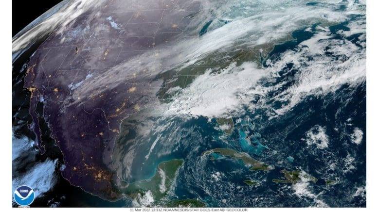
According to bulletins from the National Weather Service, north Georgia, including Cobb County will be under a wind advisory from 1 a.m. to 7 p.m. on Saturday, March 12, with wind gusts up to 40 mph as a storm the NWS has described in earlier bulletins as ‘powerful’ approaches us.
In addition to this, a winter weather advisory is also in effect Saturday from 4 a.m. to 1 p.m.
Wind Advisory
Here is an excerpt from the wind advisory:
…WIND ADVISORY IN EFFECT FROM 1 AM TO 7 PM EST SATURDAY…
* WHAT…Northwest winds 15 to 25 mph with gusts up to 40 mph expected.
* WHERE…Portions of central, east central, north central, northeast, northwest, southeast and west central Georgia.
* WHEN…From 1 AM to 7 PM EST Saturday.
* IMPACTS…Gusty winds could blow around unsecured objects. Tree limbs could be blown down and a few power outages may result.
PRECAUTIONARY/PREPAREDNESS ACTIONS… Use extra caution when driving, especially if operating a high profile vehicle. Secure outdoor objects.
The wind advisory lists the following counties and cities for the advisory:
Dade-Walker-Catoosa-Whitfield-Murray-Fannin-Gilmer-Union-Towns- Chattooga-Gordon-Pickens-Dawson-Lumpkin-White-Floyd-Bartow- Cherokee-Forsyth-Hall-Banks-Jackson-Madison-Polk-Paulding-Cobb- North Fulton-Gwinnett-Barrow-Clarke-Oconee-Oglethorpe-Wilkes- Haralson-Carroll-Douglas-South Fulton-DeKalb-Rockdale-Walton- Newton-Morgan-Greene-Taliaferro-Heard-Coweta-Fayette-Clayton- Spalding-Henry-Butts-Jasper-Putnam-Hancock-Warren-Troup- Meriwether-Pike-Upson-Lamar-Monroe-Jones-Baldwin-Washington- Glascock-Jefferson-Harris-Talbot-Taylor-Crawford-Bibb-Twiggs- Wilkinson-Johnson-Emanuel-Muscogee-Chattahoochee-Marion-Schley- Macon-Peach-Houston-Bleckley-Laurens-Treutlen-Stewart-Webster- Sumter-Dooly-Crisp-Pulaski-Wilcox-Dodge-Telfair-Wheeler- Montgomery-Toombs-
Including the cities of Calhoun, Dahlonega, Cleveland, Rome, Cartersville, Gainesville, Marietta, Atlanta, Lawrenceville, Athens, Carrollton, Douglasville, East Point, Decatur, Conyers, Covington, Newnan, Peachtree City, Griffin, Milledgeville, Macon, Swainsboro, Columbus, Warner Robins, Dublin, Lumpkin, Americus, Cordele, and Vidalia
Winter Weather Advisory
Here is an excerpt from the winter weather advisory:
…WINTER WEATHER ADVISORY IN EFFECT FROM 4 AM TO 1 PM EST SATURDAY…
* WHAT…A transition from rain to snow is expected early Saturday morning. Total snow accumulations are expected to be around one- half inch Saturday morning, with higher amounts of 1 to 2 inches across portions of far north Georgia.
* WHERE…Portions of north central, northeast and northwest Georgia.
* WHEN…From 4 AM to 1 PM EST Saturday.
* IMPACTS…Plan on slippery road conditions.
PRECAUTIONARY/PREPAREDNESS ACTIONS… Slow down and use caution while traveling.
Here are the counties and cities listed in the winter weather advisory:
Dade-Walker-Catoosa-Whitfield-Murray-Fannin-Gilmer-Union-Towns- Chattooga-Gordon-Pickens-Dawson-Lumpkin-White-Floyd-Bartow- Cherokee-Polk-Paulding-Cobb-Haralson-Carroll-Douglas-
Including the cities of Calhoun, Dahlonega, Cleveland, Rome, Cartersville, Marietta, Carrollton, and Douglasville
About the National Weather Service
The National Weather Service (NWS) is a part of the National Oceanic and Atmospheric Administration (NOAA).
The NWS describes its role as follows:
The National Weather Service (NWS) provides weather, water, and climate forecasts and warnings for the United States, its territories, adjacent waters and ocean areas, for the protection of life and property and the enhancement of the national economy. These services include Forecasts and Observations, Warnings, Impact-based Decision Support Services, and Education in an effort to build a Weather-Ready Nation. The ultimate goal is to have a society that is prepared for and responds to weather, water and climate events.
Read all the Cobb County Courier climate and weather coverage by following this link.