In the previous Cobb by the Numbers we looked at the release of the complete individual records for the 1950 decennial census. By federal law detailed census records for individual households can’t be released until 72 years after the census. The detailed records are the handwritten standardized forms familiar to genealogists and historians.
Now we’ll start focusing on how to get at the records for each part of the county, starting with Mableton. This article is mostly intended to give readers a means of looking further into into what Mableton looked like at the time of that census, rather than to give an in-depth statistical or demographic analysis of the area.
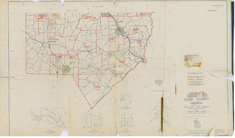
The first thing a person who looks at the 1950 census maps containing Mableton will notice is that our current conception of Mableton is much larger than what the U.S. Census Bureau considered to be Mableton in 1950.
Here’s an image of the 1950 map (I’ll show you how to get to an interactive version of the map later in the article):

By comparison, the proposed City of Mableton that will likely be on the ballot in November has borders that extend from Hurt Road on the North to the tip of the county on the south, and extends from Austell to the Chattahoochee River east to west. (Here is a link to the interactive map that includes the proposed city).
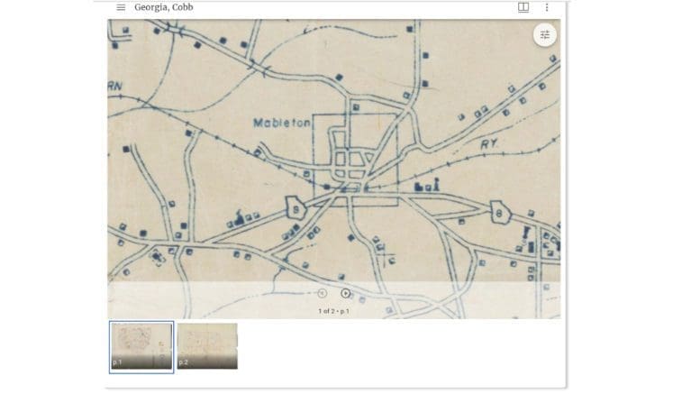
Here is a screenshot of the interactive map:

So to look for 1950 census records reflecting the current conception of Mableton, on the map screenshoted below you’d have to do searches on enumeration districts 8, 9, 45, 59 and 60 in order to reach all the records for people living in those areas.
An explanation for how to get to those enumeration districts is reprinted below from our earlier article.
How to get to the 1950 census records
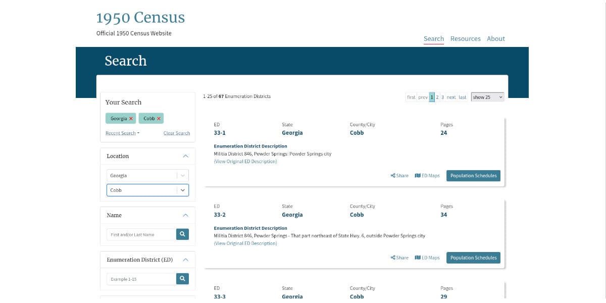
To get to the records you can go to the search page at the National Archives by following this link, then hitting the “Begin Search” button and on the left-hand panel selecting “Georgia” and “Cobb County” under the state and county pull-down.
Or more quickly, you can go there via this link to the search that I’ve already done.
Cobb was divided into 67 enumeration districts in 1950, so you’ll be presented with a screen that looks like this:
At this point unless you’re familiar with historical geographies like the militia districts, you might have to muddle around a little to find the area you’re looking for, so clicking on the button marked “ED Maps” will give you an interactive map that is helpful in finding what you are looking for.
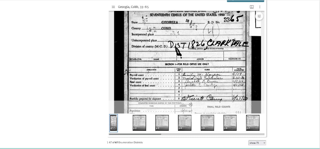
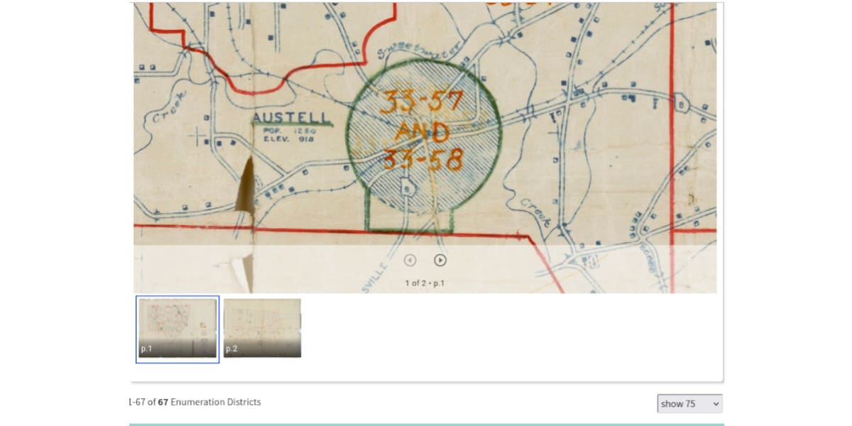
But for a simple example, let’s imagine I’m doing research on the Clarkdale thread mill district near Austell. I scrolled down to it, clicked on “Population schedules,” and came to this screen:
You can also get to a map of the enumeration district to make certain that if you’re searching for an individual you aren’t outside the boundaries of where that person lived.
You’ll have to use your mouse or key commands to pan around on the map and zoom in or out, but here’s what I got for the Clarkdale area.
That should be enough to get you started in exploring a part of the county’s development when we were just at the beginning of the explosive growth to come.
How to used these records to build a more complete picture of Mableton in 1950
Finding the records is just a first step. The Census Bureau is getting volunteers to transcribe the records for different areas so that the records are searchable and more easily readable. To learn how to help with this project follow this link.
Also, the Cobb Public Library is in the process of digitizing their collection of city directories, including the ones that covered Mableton and Austell. When that is done matching census records against addresses and the owners of area businesses in city directories, which are arranged in sections for both name and street, could create a further picture of Mableton as it existed in 1950.