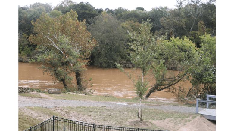
[Photo: Chattahoochee in the aftermath of a flood/Larry Felton Johnson]
The National Weather Service, announced that a flood warning will remain in effect until just after midnight in Cobb County and the region. In Cobb County this mainly affects Sweetwater Creek. The warning will remain in effect until Friday, January 12 (just after midnight Thursday).
The statement describes the impact on Cobb and Douglas counties so far as follows:
Minor flooding continues in the woodlands and fields upstream and downstream from the gage near the Interstate 20 bridge. Portions of a paintball playing field just downstream of the bridge and athletic fields in the Woodrow Wilson Park on Mount Vernon Road are flooded with one to two feet of water. A portion of Wren Circle in Douglas County…the County Iron Works and Sunlight Drive in Cobb County begin to flood.
What is the difference between a watch and a warning?
The National Weather Service describes the difference between a “watch” and a “warning” as follows:
“As the event becomes imminent, a watch will normally be upgraded to either a warning or an advisory (which indicates an 80% or greater probability of occurence).
“A Warning indicates that conditions pose a threat to life or property, and that travel will become difficult to impossible. “
“An Advisory indicates conditions pose a significant inconvenience, and if caution is not exercised, could lead to situations that may threaten life and/or property.”
What is in the warning?
Here is the complete text of the flood warning (it repeats, but we decided to include the complete text):
Flood Statement
National Weather Service Peachtree City GA
516 AM EST Thu Jan 11 2024
…The Flood Warning continues for the following rivers in Georgia…
Tennessee…Alabama…
Yellow River at Gees Mill Road affecting Newton and Rockdale
Counties.
West Chickamauga Creek at GA 146 near Lakeview affecting Hamilton
and Catoosa Counties.
Coahulla Creek at Keiths Mill Road near Dalton affecting
Whitfield County.
Chattahoochee River at 14th Street at Columbus affecting Russell,
Chattahoochee, Muscogee and Lee Counties.
Sweetwater Creek near Austell affecting Cobb and Douglas Counties.
Broad River near Broad River above Carlton affecting Madison,
Oglethorpe and Elbert Counties.
For the North GA Chickamauga Creek Basin…including Ringgold,
Lakeview…Minor flooding is forecast.
For the Conasauga River Basin…including Eton, Crandall, Dalton,
Dalton, Chatsworth, Tilton, Sloan Bridge below Dalton…Minor
flooding is forecast.
For the Chattahoochee River Basin…including Helen, Dahlonega,
Cornelia, Suwanee, Buford, Suwanee, Buford, Chattahoochee River
upstream McGinnis Ferry Rd, Norcross, Chattahoochee River above
Roswell, Roswell, Powers Ferry & I285 Atlanta, Smyrna, Chattahoochee
River below Morgan Falls Dam, Atlanta, Atlanta, Atlanta, Atlanta,
Fairplay, Fairburn, Whitesburg, Whitesburg, Whitesburg, Franklin,
Corinth, Hammett Rd below Hogansville, Franklin, West Point,
Columbus, Union, Omaha…Minor flooding is forecast.
For the Sweetwater Creek…including Powder Springs, Powder Springs,
Powder Springs, Austell, Austell, Austell, Sweetwater Creek below
Austell…Minor flooding is forecast.
For the Broad River…including Broad River above Carlton,
Commerce…Minor flooding is forecast.
PRECAUTIONARY/PREPAREDNESS ACTIONS…
Turn around, don`t drown when encountering flooded roads. Most flood
deaths occur in vehicles.
Motorists should not attempt to drive around barricades or drive
cars through flooded areas.
Additional information is available at weather.gov/atlanta.
The next statement will be issued at 300 PM EST.this afternoon at
1215 PM EST /1115 AM CST/.
&&
GAC067-097-112230-
/O.CON.KFFC.FL.W.0048.000000T0000Z-240112T0621Z/
/AUSG1.1.ER.240110T0715Z.240111T1200Z.240112T0021Z.NO/
516 AM EST Thu Jan 11 2024
…FLOOD WARNING REMAINS IN EFFECT UNTIL JUST AFTER MIDNIGHT
TONIGHT…
* WHAT…Minor flooding is occurring and minor flooding is forecast.
* WHERE…Sweetwater Creek near Austell.
* WHEN…Until just after midnight tonight.
* IMPACTS…At 12.0 feet, Minor flooding continues in the woodlands
and fields upstream and downstream from the gage near the
Interstate 20 bridge. Portions of a paintball playing field just
downstream of the bridge and athletic fields in the Woodrow Wilson
Park on Mount Vernon Road are flooded with one to two feet of
water. A portion of Wren Circle in Douglas County…the County
Iron Works and Sunlight Drive in Cobb County begin to flood.
* ADDITIONAL DETAILS…
– At 5:00 AM EST Thursday the stage was 11.5 feet.
– Recent Activity…The maximum river stage in the 24 hours
ending at 5:00 AM EST Thursday was 11.8 feet.
– Forecast…The river is expected to rise to a crest of 12.0
feet this morning. It will then fall below flood stage this
evening.
– Flood stage is 10.0 feet.
– Flood History…This crest compares to a previous crest of
12.0 feet on 02/08/2020.
– http://www.weather.gov/safety/flood
About the National Weather Service
The National Weather Service (NWS) is a part of the National Oceanic and Atmospheric Administration (NOAA).
The NWS describes its role as follows:
The National Weather Service (NWS) provides weather, water, and climate forecasts and warnings for the United States, its territories, adjacent waters and ocean areas, for the protection of life and property and the enhancement of the national economy. These services include Forecasts and Observations, Warnings, Impact-based Decision Support Services, and Education in an effort to build a Weather-Ready Nation. The ultimate goal is to have a society that is prepared for and responds to weather, water and climate events.
Read all the Cobb County Courier climate and weather coverage by following this link.