Immediately after coming off two days of high fire danger in Cobb County, we are now faced with the possibility of severe thunderstorms, and even a slight possibility of a tornado.
According to a hazardous weather outlook from the National Weather Service, a number of counties in north and central Georgia, including Cobb County, are in the path of strong storms coming in from the west.
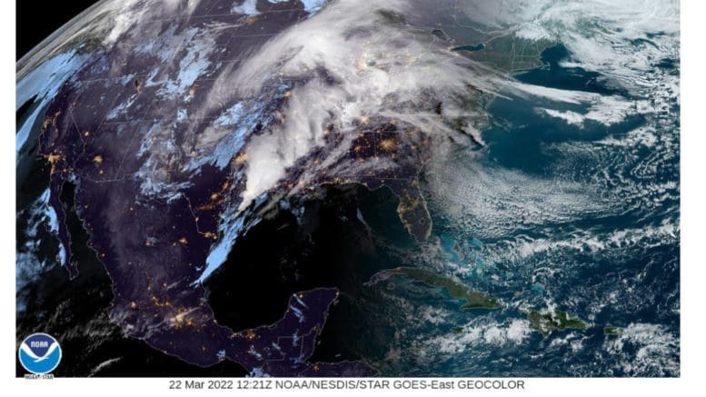
The storms are expected to hit Georgia after 3 a.m. Wednesday morning, and the brunt of the storm is initially forecast to hit west central Georgia.
What does the National Weather Service say?
The National Weather Service posted the following in their Hazardous Weather Outlook:
This Hazardous Weather Outlook is for portions of North and Central Georgia
. .DAY ONE…Today and Tonight…
Isolated strong to severe storms are possible over west-central Georgia late tonight, after 3 AM Wednesday morning, as the strongest part of a line of thunderstorms moves in from central Alabama. These storms could produce damaging winds, hail, very heavy rain and an isolated tornado.
.DAYS TWO THROUGH SEVEN…
Wednesday through Monday…
Strong to severe thunderstorms with damaging winds, hail, heavy rain, and brief, isolated tornadoes, will continue to be possible Wednesday, mainly along and south of Interstate 85. Larger creeks and rivers may rise to near or above flood stage on Wednesday and continue high on Thursday. Please refer to river forecasts and statements for specific information. Otherwise, no other hazardous weather is expected.
What counties are in the hazardous weather outlook?
The following counties are listed in the hazardous weather outlook:
Baldwin-Banks-Barrow-Bartow-Bibb-Bleckley-Butts-Carroll-Catoosa- Chattahoochee-Chattooga-Cherokee-Clarke-Clayton-Cobb-Coweta- Crawford-Crisp-Dade-Dawson-DeKalb-Dodge-Dooly-Douglas-Emanuel- Fannin-Fayette-Floyd-Forsyth-Gilmer-Glascock-Gordon-Greene- Gwinnett-Hall-Hancock-Haralson-Harris-Heard-Henry-Houston-Jackson- Jasper-Jefferson-Johnson-Jones-Lamar-Laurens-Lumpkin-Macon- Madison-Marion-Meriwether-Monroe-Montgomery-Morgan-Murray- Muscogee-Newton-North Fulton-Oconee-Oglethorpe-Paulding-Peach- Pickens-Pike-Polk-Pulaski-Putnam-Rockdale-Schley-South Fulton- Spalding-Stewart-Sumter-Talbot-Taliaferro-Taylor-Telfair-Toombs- Towns-Treutlen-Troup-Twiggs-Union-Upson-Walker-Walton-Warren- Washington-Webster-Wheeler-White-Whitfield-Wilcox-Wilkes- Wilkinson-
How does this short-term forecast relate to overall climate trends for the region?
There isn’t a one-to-one relationship between weather and climate trends. It’s possible to have blizzards in a year when the overall temperatures are warming.
But the thunderstorms are consistent with a trend reported by climate scientists in the article at this link of wetter weather in the eastern United States, and drier weather in the western portion of the country, due to the effects of climate change.
7-day forecast
The following is the NWS 7-day weather forecast, centered on Dobbins ARB in Marietta:
Today Partly sunny, with a high near 75. Southeast wind 5 to 15 mph, with gusts as high as 20 mph.
Tonight A chance of showers and thunderstorms, then showers and possibly a thunderstorm after 2am. Low around 59. Southeast wind around 15 mph, with gusts as high as 25 mph. Chance of precipitation is 80%. New rainfall amounts between a half and three quarters of an inch possible.
Wednesday Showers and thunderstorms before 2pm, then a chance of showers. High near 73. South wind 10 to 15 mph, with gusts as high as 25 mph. Chance of precipitation is 80%. New rainfall amounts between a quarter and half of an inch possible.
Wednesday Night A 20 percent chance of showers before 2am. Partly cloudy, with a low around 47. South wind 5 to 10 mph becoming west after midnight. Winds could gust as high as 15 mph.
Thursday Mostly sunny, with a high near 63. West wind 5 to 10 mph, with gusts as high as 20 mph.
Thursday Night Partly cloudy, with a low around 43.
Friday Mostly sunny, with a high near 59.
Friday Night Partly cloudy, with a low around 43.
Saturday Sunny, with a high near 58.
Saturday Night Mostly clear, with a low around 37.
Sunday Sunny, with a high near 60.
Sunday Night Mostly clear, with a low around 41.
Monday Sunny, with a high near 71.
About the National Weather Service
The National Weather Service (NWS) is a part of the National Oceanic and Atmospheric Administration (NOAA).
The NWS describes its role as follows:
The National Weather Service (NWS) provides weather, water, and climate forecasts and warnings for the United States, its territories, adjacent waters and ocean areas, for the protection of life and property and the enhancement of the national economy. These services include Forecasts and Observations, Warnings, Impact-based Decision Support Services, and Education in an effort to build a Weather-Ready Nation. The ultimate goal is to have a society that is prepared for and responds to weather, water and climate events.
Read all the Cobb County Courier climate and weather coverage by following this link.