According to the report from the National Weather Service, we have another wave of stormy weather headed our way here in Cobb County and we can expect a high temperature near 77 degrees.
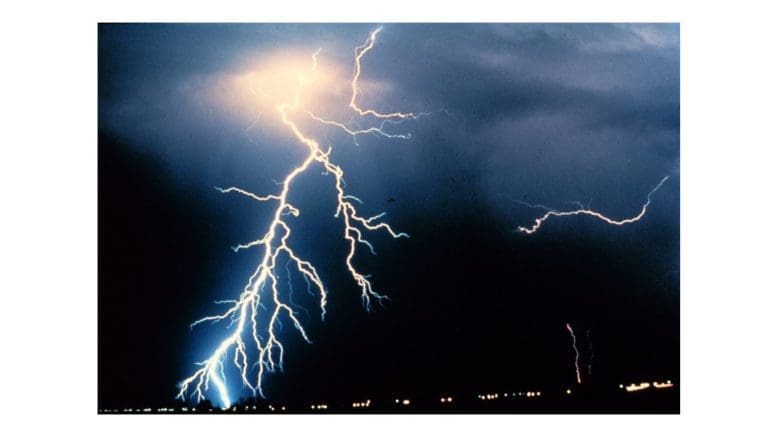
The NWS has issued another hazardous weather outlook for Cobb County and much of the rest of north Georgia for this evening as the showers and thunderstorms become more intense in the evening.
What is in the hazardous weather outlook?
The NWS reports the following:
This Hazardous Weather Outlook is for portions of North and Central Georgia.
.DAY ONE…Today and Tonight…
Several rounds of showers and thunderstorms will move across the
area this afternoon and overnight. Some storms may become strong
to severe and capable of producing damaging wind gusts and large
hail. A tornado or two are possible. Localized flooding and flash
flooding is possible, especially in areas that received heavy
rainfall on Tuesday.
.DAYS TWO THROUGH SEVEN…Thursday through Tuesday…
No hazardous weather is expected at this time.
What time period does it cover?
The showers and thunderstorms are expected to roll in Wednesday afternoon on April 6, There is no hazardous weather forecast at this time for Thursday.
What counties are affected in the hazardous weather outlook?
The following counties are listed in the report:
Baldwin-Banks-Barrow-Bartow-Bibb-Bleckley-Butts-Carroll-Catoosa-
Chattahoochee-Chattooga-Cherokee-Clarke-Clayton-Cobb-Coweta-
Crawford-Crisp-Dade-Dawson-DeKalb-Dodge-Dooly-Douglas-Emanuel-
Fannin-Fayette-Floyd-Forsyth-Gilmer-Glascock-Gordon-Greene-
Gwinnett-Hall-Hancock-Haralson-Harris-Heard-Henry-Houston-Jackson-
Jasper-Jefferson-Johnson-Jones-Lamar-Laurens-Lumpkin-Macon-
Madison-Marion-Meriwether-Monroe-Montgomery-Morgan-Murray-
Muscogee-Newton-North Fulton-Oconee-Oglethorpe-Paulding-Peach-
Pickens-Pike-Polk-Pulaski-Putnam-Rockdale-Schley-South Fulton-
Spalding-Stewart-Sumter-Talbot-Taliaferro-Taylor-Telfair-Toombs-
Towns-Treutlen-Troup-Twiggs-Union-Upson-Walker-Walton-Warren-
Washington-Webster-Wheeler-White-Whitfield-Wilcox-Wilkes-
Wilkinson
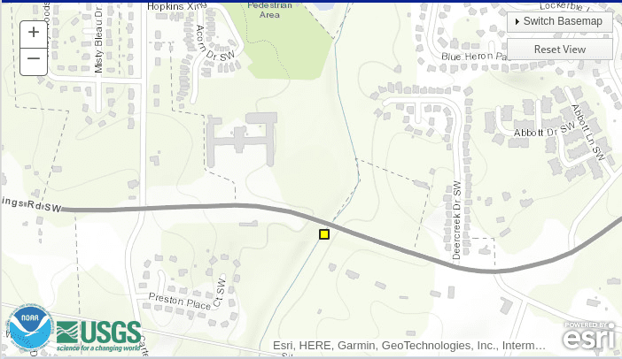
What does this morning’s flood map show?
While there is no reported flooding shown on the NWS flood map for Cobb County as of 6 a.m. Wednesday morning, there are near flood conditions in Powder Springs at Noses Creek just north of the Silver Comet Trail. The yellow rectangle on the map below indicated the area:
7-day forecast
Weather forecast centered on Dobbins AFB, Marietta
Today
A chance of showers and thunderstorms, then showers likely and possibly a thunderstorm after 5pm. Cloudy, with a high near 77. South wind 5 to 10 mph, with gusts as high as 20 mph. Chance of precipitation is 60%.
Tonight
Showers and possibly a thunderstorm before 2am, then a chance of showers and thunderstorms, mainly between 2am and 4am. Some of the storms could be severe. Low around 50. South wind around 10 mph becoming northwest after midnight. Winds could gust as high as 20 mph. Chance of precipitation is 80%. New rainfall amounts between a quarter and half of an inch possible.
Thursday
Mostly sunny, with a high near 65. West wind 10 to 15 mph, with gusts as high as 25 mph.
Thursday Night
Partly cloudy, with a low around 43. West wind 5 to 10 mph, with gusts as high as 20 mph.
Friday
Mostly sunny, with a high near 57. West wind 10 to 15 mph, with gusts as high as 30 mph.
Friday Night
Partly cloudy, with a low around 36.
Saturday
Mostly sunny, with a high near 54.
Saturday Night
Mostly clear, with a low around 36.
Sunday
Sunny, with a high near 66.
Sunday Night
Mostly clear, with a low around 45.
Monday
Mostly sunny, with a high near 75.
Monday Night
A 20 percent chance of showers. Mostly cloudy, with a low around 53.
Tuesday
A 30 percent chance of showers. Mostly cloudy, with a high near 73.
## climate summary for Atlanta area
About the National Weather Service
The National Weather Service (NWS) is a part of the National Oceanic and Atmospheric Administration (NOAA).
The NWS describes its role as follows:
The National Weather Service (NWS) provides weather, water, and climate forecasts and warnings for the United States, its territories, adjacent waters and ocean areas, for the protection of life and property and the enhancement of the national economy. These services include Forecasts and Observations, Warnings, Impact-based Decision Support Services, and Education in an effort to build a Weather-Ready Nation. The ultimate goal is to have a society that is prepared for and responds to weather, water and climate events.
Read all the Cobb County Courier climate and weather coverage by following this link.