[This an evergreen article that we periodically republish as our readership grows, with added materials from the Georgia Historic Newspapers database and website housed at the University of Georgia as we discover them]
Each year the Marietta History Center participates in the Dixie Highway Yard Sale, and there are remnant signs in Georgia marking the once-important road.
But what was the Dixie Highway?
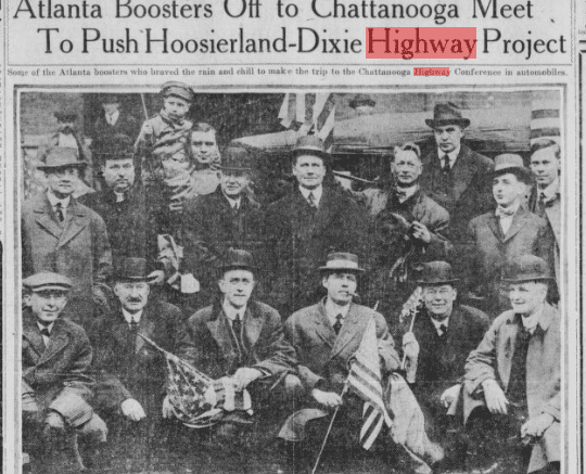
The Dixie Highway was one of the earliest attempts at building a north-to-south interstate highway system. It was a network of roads from Canada to Florida. U.S. Highway 41 along its early path was part of the network, as was Atlanta Road.
The Cobb County segment followed present-day Old Highway 41 and Atlanta Road, running from Acworth to the Chattahoochee River near Smyrna.
Before the development of that highway, there were no paved highways in Georgia, and paving was left to local roads in the cities.
Before the Dixie Highway
The movement to pave roads didn’t begin with the rise of the automobile. It began in the 1870s with the increase in bicycle usage, and an alliance between cyclists, farmers and the U.S. Post Office, all of whom had their own reasons for preferring smooth paved roads to the mud roads and highways that often became lakes of muck with heavy rains.
The League of American Wheelmen (now called the League of American Bicyclists), the largest cycling organization in the U.S., published an open letter to farmers in 1891 urging them to become involved in the Committee for Improvement of the Highways.
This alliance developed into the Good Roads Movement, which received further impetus when the automobile became the primary mode of transportation in the U.S.
The beginning of the Dixie Highway
The Dixie Highway itself began with the purchase of an island off Miami, Florida, in 1912 by an entrepreneur and important auto industry executive named Carl Fisher. Fisher planned to develop the island into a tourist destination and resort. That island later became known as Miami Beach.
Fisher knew that for the project to be successful, Miami Beach would have to be accessible to the Model T Fords, which had increased in popularity and affordability since manufacture began in 1908.
The Dixie Highway was not Fisher’s first role in developing the U.S. highway system. He was instrumental in the planning and building of the Lincoln Highway between New York City and San Francisco.
So in 1914, he contacted Samuel Ralston, the governor of Indiana, to propose that governors of the states between the upper Midwest and Florida discuss a north-to-south paved highway.
The idea was so popular within the states along the proposed route that the Dixie Highway was never one single road but a north-to-south network of roads that would split at various points into parallel highways based on the politics and lobbying for cities along the routes.
Part of the lobbying effort during America’s involvement in World War I was to emphasize the highway’s usefulness to the war effort.
In the May 12, 1918 edition of the Atlanta Georgian, the Hearst paper published in Atlanta at the time, V.D.L. Robinson, the secretary of the Dixie Highway Association, wrote a front-page opinion piece entitled “Highways as War Measures: Good Roads Essential to Many Cantonments Located in Georgia.”
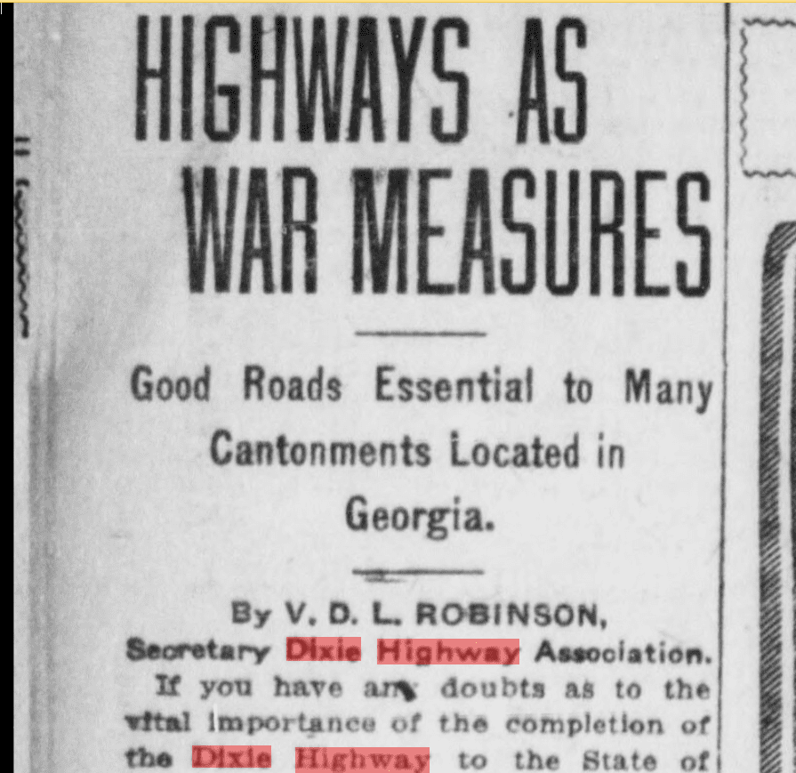
“Ask Colonel L. N. Gallagher, quartermaster of the Southeastern depot, what a well-paved highway from Detroit or Chicago to Atlanta would mean to the nation at war,” wrote Robinson in the article. “It would permit fleets of motor trucks required in the eighteen military cantonments in the Southeast to be driven through, loaded with Government supplies, as they are now doing from Detroit to the Atlantic coast.”
Cobb County and the Dixie Highway
Georgia had a web of Dixie Highway components that became four separate roads by the time it entered Florida.
Cobb County was on the northwestern segment of the Dixie Highway that entered Georgia via Chattanooga, and ran through Acworth and Marietta on the current path of Old Highway 41. According to Thomas Scott in his book Cobb County and the Origins of the Suburban South, the Atlanta Road segment of the Dixie Highway was hard-surfaced between Marietta and Smyrna in 1920, and by 1923 the section between Smyrna and the Chattahoochee River was paved.
At the same time the cities within the county were paving their local roads, with Marietta taking the lead with a bond issue for paving roads leading into the city in 1921.
The end of the Dixie Highway
The decline of the Dixie Highway was a result of its success. By the late 1920s the federal government was providing funds for highway improvement, and created a system of numbered highways, which supplanted named highways like the Dixie Highway. Different branches of the road network were given numeric names.
The growth of the interstate highway system in the post-WWII period dealt the final blow to the Dixie Highway, as the remaining segments of the highway became less important for regional travel.
But the Dixie Highway pioneered interstate paved highways, and created lasting commercial activity along its entire length from Canada to Florida.
To read more about the Dixie Highway
Ed Jackson, who was with UGA’s Carl Vinson Institute of Government, and who died in January of this year, wrote a really nice concise history of the Dixie Highway, complete with maps and photos. You can read his work by following this link.
The New Georgia Encyclopedia has a page about the Dixie Highway.
Dr. Thomas Scott’s book Cobb County and the Origins of the Suburban South has Cobb County-specific information about the development of the highway.