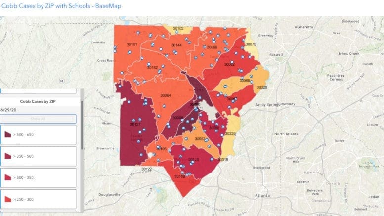
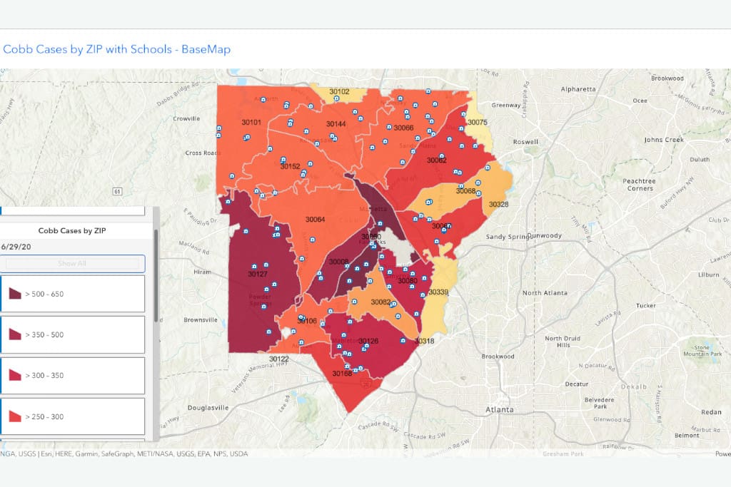
Cobb GIS announced yesterday on Twitter that they have created an interactive map featuring the number of COVID-19 cases by zip code, along with the locations of nearby schools.
The map also has a menu system allowing you to choose a range of cases and see which zip codes fall within that range.
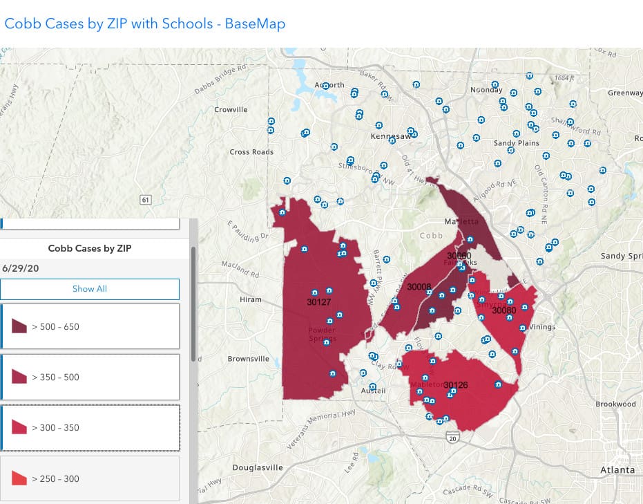
For instance, if you click on the top range, it becomes evident the largest number of cases are in the Marietta and Fair Oaks areas.
On the map above the menu on the left gives you filters the map by range of cases. For instance, if we choose the top three ranges, we find that the hardest-hit zip code is Marietta and Fair Oaks zip 30060 with 500-650 cases, followed by zip codes 30008 and 30127, and finally in the third slot 30080 and 30126, in the 300-350 range each.
The map below illustrates this.
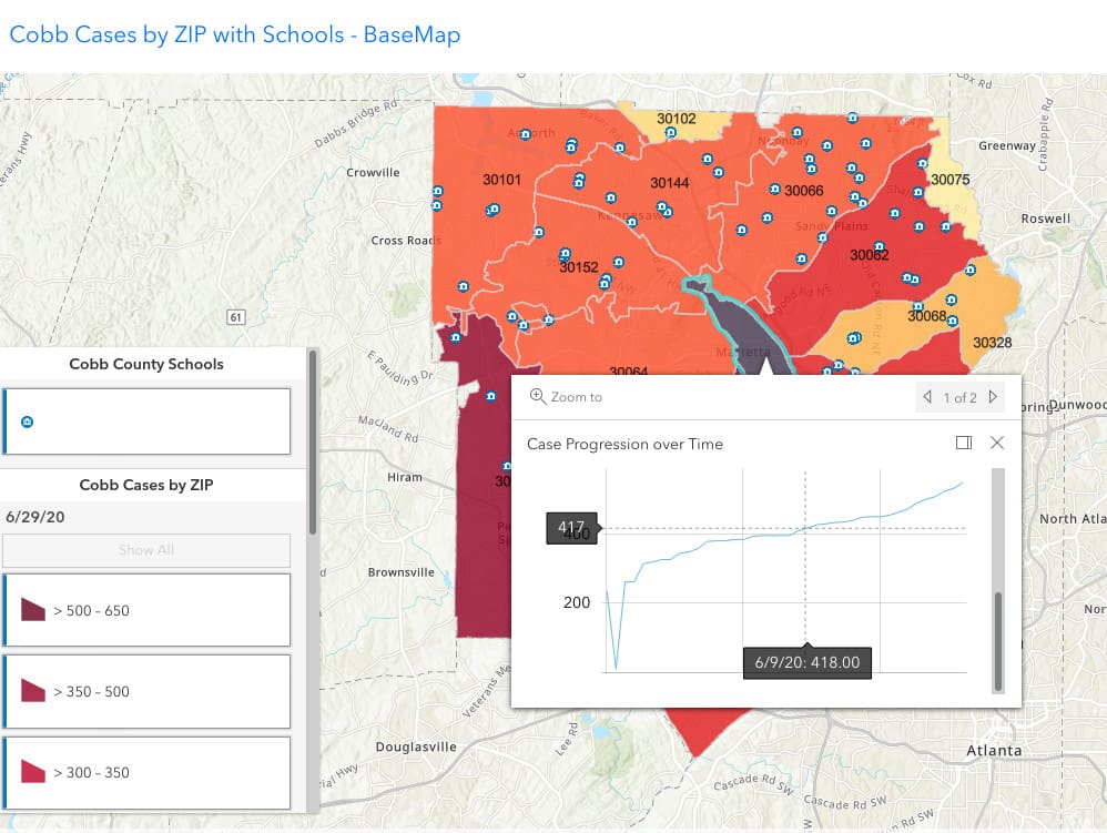
Another feature of the interactive map is that if you click on a particular zip code on the map, it will allow you to see the progression of cases over time.
For instance, in the map below, we’ve clicked on 30080, and run our mouse pointer along the graph line to June 6, and found that on that date the zip code had experienced 418 cases.
This gives the ability to track increases within the zip code.
The Cobb GIS map is a good tool to use in conjunction with the Cobb & Douglas Public Health COVID-19 daily report page and the Georgia Department of Public Health daily status report.
Using the three sources of information in conjunction with each other gives a good overview of confirmed cases, hospitalizations, deaths, changes in number of cases over time, and which parts of the county and state are hardest hit.
You can visit the map by following this link.