Today has been a big day for weather news, and the Cobb County government pointed out this afternoon on its Twitter account that the maps from the National Weather Service about the oncoming wintery weather include a slice of the northwest corner of Cobb County:
No need to panic, but the Weather Service says part of NW Cobb could see some wintry precip overnight. No significant issues are expectecd, but @CobbDOT will monitor road condtions for the morning commute. Counties to our north & west are included in a Winter Weather Advisory.
We are still under a hazardous weather outlook due to the thunderstorms and showers that are continuing to roll in.
The Hazardous Weather Outlook reads as follows:
.DAY ONE…
Today and Tonight…
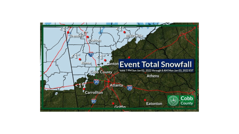
A line of showers and thunderstorms will move across portions of north and central Georgia today. Some of the storms could become strong to severe. The primary threats will be damaging wind gusts, periods of heavy rain, and isolated brief tornadoes. A Winter Weather Advisory is in effect from midnight tonight to 9AM Monday for portions of far North Georgia. Rain showers transitioning to snow are possible beginning tonight. Slow down and use caution when driving as roads may be hazardous. .
DAYS TWO THROUGH SEVEN…
Monday through Saturday…
Snow showers are possible through early Monday morning, especially in areas of high terrain in the north Georgia mountains. Up to two inches of snow are possible and winds could gust as high as 35 mph at elevations above 2000 feet. Snow accumulations of up to one inch are possible elsewhere. Please use caution when driving as roads may become slick. .
SPOTTER INFORMATION STATEMENT…
Spotter activation is requested for today across portions of north and central Georgia.