After a cautionary message that the combination of low humidity and breezy winds create elevated conditions for the spread of fires in Cobb County and the rest of north Georgia, the National Weather Service wrote in a further alert that the conditions might extend through Monday and worsen.
A separate Special Weather Statement also stated that the affected area is approaching Red Flag Warning condition and that the NWS is monitoring the situation.
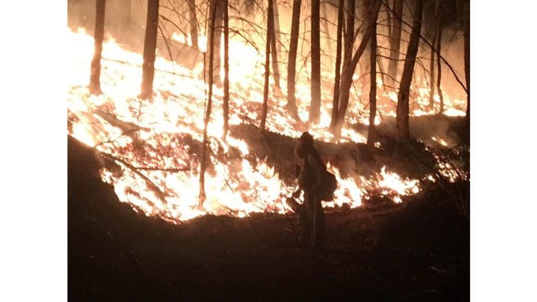
What is a Red Flag Warning?
According to the definition on the National Weather Service website:
A Red Flag Warning means warm temperatures, very low humidities, and stronger winds are expected to combine to produce an increased risk of fire danger.
-If you are allowed to burn in your area, all burn barrels must be covered with a weighted metal cover, with holes no larger than 3/4 of an inch.
-Do not throw cigarettes or matches out of a moving vehicle. They may ignite dry grass on the side of the road and become a wildfire.
-Extinguish all outdoor fires properly. Drown fires with plenty of water and stir to make sure everything is cold to the touch. Dunk charcoal in water until cold. Do not throw live charcoal on the ground and leave it.
-Never leave a fire unattended. Sparks or embers can blow into leaves or grass, ignite a fire, and quickly spread.
Further information on current fire hazard conditions
The NWS also posted the following in a separate message:
This Hazardous Weather Outlook is for portions of North and Central Georgia
. .DAY ONE
…Today and Tonight… Hazardous fire weather conditions are expected this afternoon and evening following a cold front as a combination of dry fuels, low relative humidity values, and breezy winds will be in place during this time.
A Fire Danger Statement has been issued for these conditions. Please refer to your local burn permitting authorities whether you may burn outdoors. If you do burn outside, use extreme caution
. .DAYS TWO THROUGH SEVEN
…Monday through Saturday… Hazardous fire weather conditions will be possible once again on Monday afternoon and evening, due to a combination of dry fuels and low relative humidity values. Another strong cold front is expected later this week which will bring periods of heavy rain, and a slight chance of thunderstorms on Thursday and Friday of next week.
About the National Weather Service
The National Weather Service (NWS) is a part of the National Oceanic and Atmospheric Administration (NOAA).
The NWS describes its role as follows:
The National Weather Service (NWS) provides weather, water, and climate forecasts and warnings for the United States, its territories, adjacent waters and ocean areas, for the protection of life and property and the enhancement of the national economy. These services include Forecasts and Observations, Warnings, Impact-based Decision Support Services, and Education in an effort to build a Weather-Ready Nation. The ultimate goal is to have a society that is prepared for and responds to weather, water and climate events.
Read all the Cobb County Courier climate and weather coverage by following this link.